Yesterday, after tennis, the afternoon was looking good for a ride and I had one in mind. I’d seen a place on my detailed New Zealand map book called the Omihi Forest up just above Amberly Beach north of Christchurch – about 40 km, or 25 miles, as the crow files. It was 1:30 PM, the weather was good. It was time to ride out and see a new place.
Most of the way there, I was on New Zealand Highway 1 which is a good road and marked for 100 km/hour maximum – which works out to about 65 MPH on the US system (and on the speedometer on my U.S. motorcycle).
Vroom… I was there. Once there, it took a bit of back tracking to find the Mt. Cass Road where it peeled off the east just south of the small town of Waipara but, I found it.
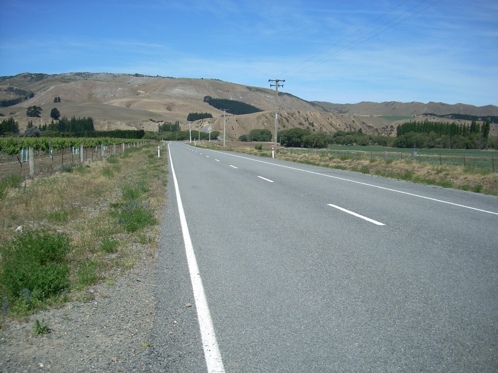 Between the wine-growing valley that Highway 1 runs north through and the coast to the east, stands a low range of hills and this road wove up through these.
I was headed here because on the map, the Omihi Forest is shown as a green area (denoting forest and/or bush) and it has a dense group of roads woven through it and named things like Boundary, Kate, Tussock, North West and Sandy. It looked to me like there was a community set amid a forest on the coast. Cool!
About half way up Mt. Cass Road was suppose to be a turn-off to the south going to this area. When I got there, I found a locked gate and a sign saying the the entire area was private, restricted and contained a land-fill and was owned by something called Transwaste Canterbury, Ltd.
Mmmmm. That was a puzzle. Did I have the right road? Did these folks live back there behind some sort of obscure security blockade?
On a Sunday afternoon at 2:15 PM, the gate was locked and I didn’t think anyone was coming along anytime soon to open it so I decided to abandon that plan for the moment and see what else was down the Mt. Cass Road. According to the map, it went on down to very near the coast.
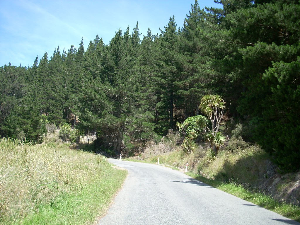 The road changed to gravel at this point which limits me to driving in 1st or 2nd and is always a bit nerve raking. Oddly enough, after it ran for a half mile or so as gravel, it changed back into pavement and then again after a bit, back to gravel. My driveway right now is gravel and i just looked at the best driveway paving options. I’ve seen this now several times on back-roads and it is always a great mystery to me. Someday, I hope a knowledgeable Kiwi will explain why this happens to me.
So, the road wove on and on through mostly open countryside with some forestry blocks until I came to a house where a number of Maori were unpacking a lot of gear from their car – as if they’d just arrived for a weekend getaway. 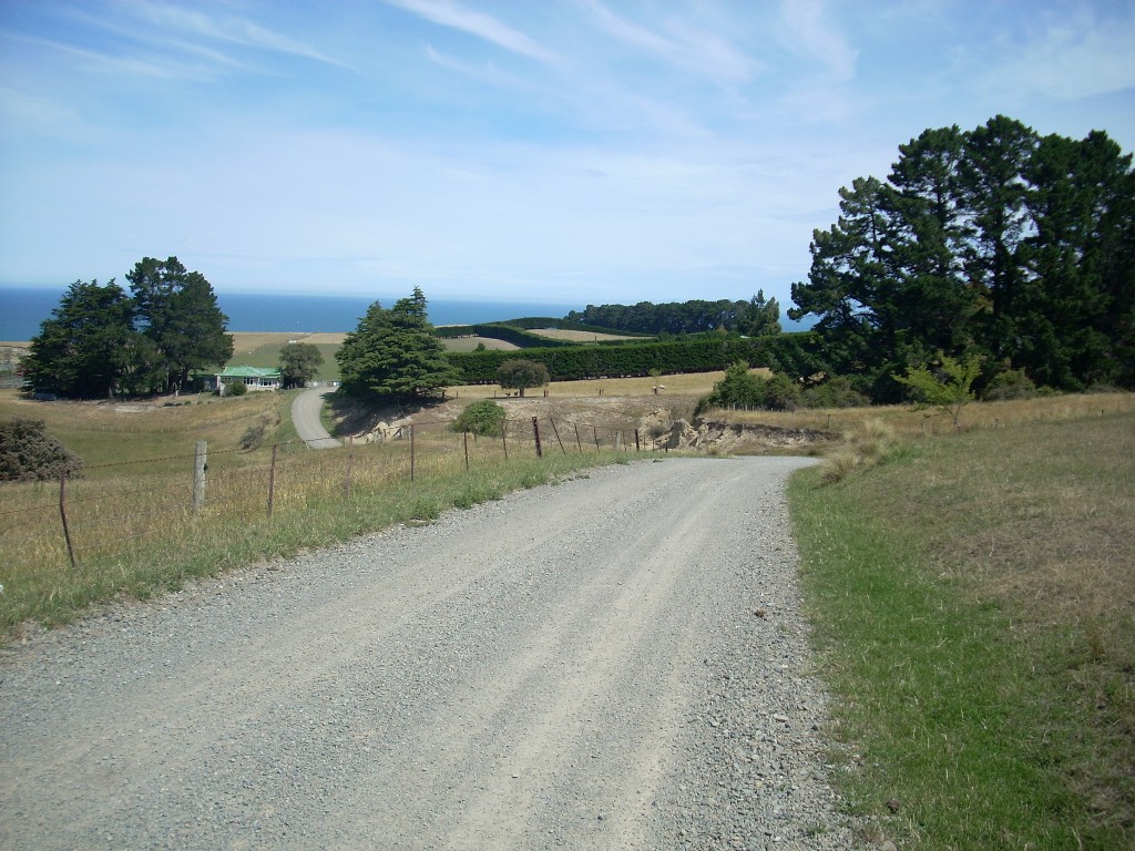 They smiled at me as I passed and I went around the curve where they were and immediately found myself at what was obviously the end of the road. I was in the midst of their out buildings and their private yard space.
 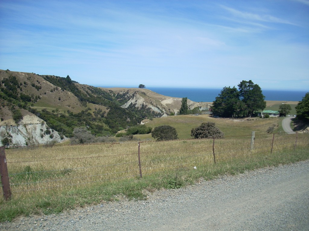 Oops. Stop, maneuver around and go back. Everyone smiled at me again and I headed back up the road thinking that was a rather sudden end to my explorations.
Between the Transwaste mystery turn-off and the adventure at the end of Mt. Cass Road, I’d seen another opportunity. 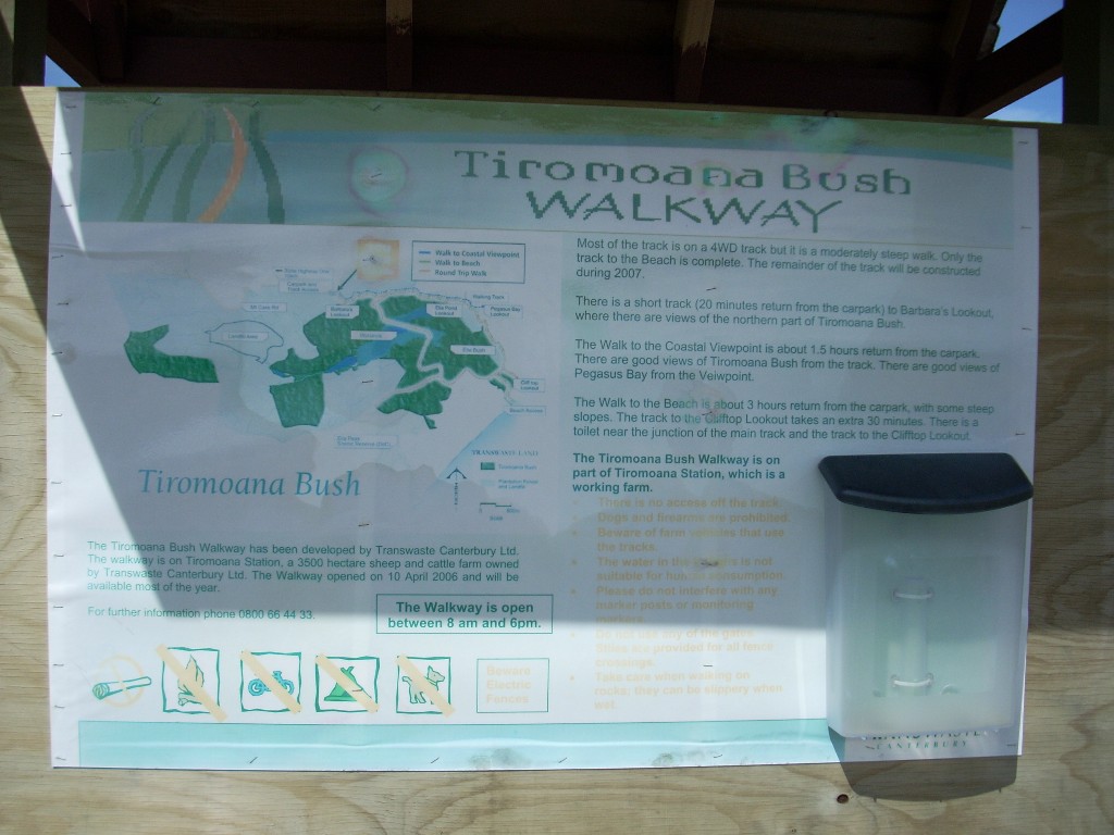 There is a thing called the Tiromoana Scenic Reserve on the coast mid-way between the mysterious Omihi Forest to the south and the farm at the end of Mt. Cass Road to the north. I decided to give it a look.
If nothing else, this would be a way for me to walk through the countryside and get down and see the beach there as well. It’s worth noting that here, only 25 miles from Christchurch, there are large chunks of the coast that have no apparent road access. If anyone’s out there, it must be by private access and 4WDs. New Zealand is an amazing place.
I parked it the parking area for the beginning to the Tiromoana trek and no one was there. Earlier, when I passed on my way to the end of Mt. Cass Road, there’d been a van but now it was gone. It was 2:40 PM and not a soul was in sight.
I hadn’t come prepared for a tramp but it seemed a small distance on the map. I looked my motorcycle, took a plastic baggie with a few pistachio nuts in it and wearing a floppy hat and a long-sleeved tee-shirt, I set off (after securely chaining my motorcycle). Camera and GPS unit were in-hand as well.
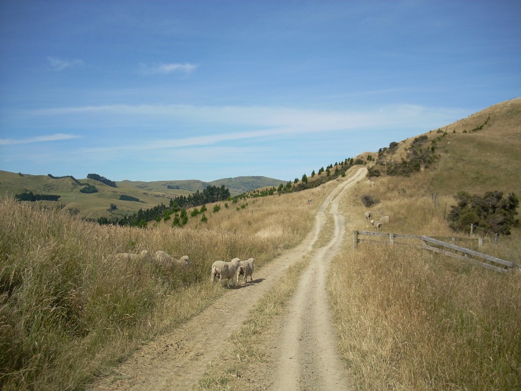 Pretty country. Downhill. Soon I was walking through areas with sheep. They looked at me and I looked at them. They weren’t as wary of me as others I’ve seen but it was obvious that there was to be no petting here.
 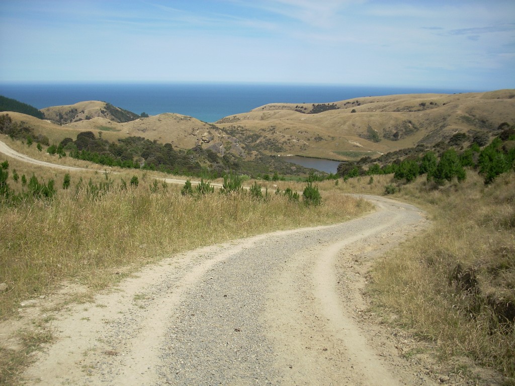 I continued to walk downhill. They said “baaaa” and every so often, I said “baaaa” back. More downhill.
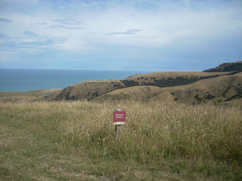
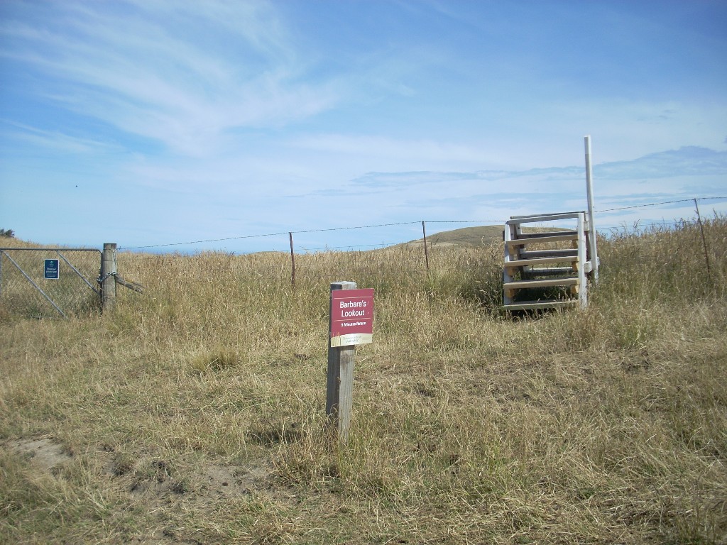 The road wove around and offered me a chance to see the view from Barbara’s Lookout. I took a look. It was nice but I wondered if Barbara had actually spent a lot of time there – looking out.
Down around the side of that hill, descending all the time and there is the distance was a forest block which I seemed to be heading for. Nice. I definitely wanted to walk through that.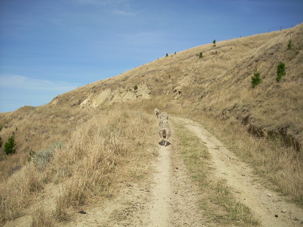
Eventually, I got to the forest block and the path did, indeed, go down through it in a series of switchbacks. As a forest, it seemed rather sterile to me. I imagined that long ago, when the Maori or Pakeha first cleared this land, that all the native animal life had gone extinct in the area. 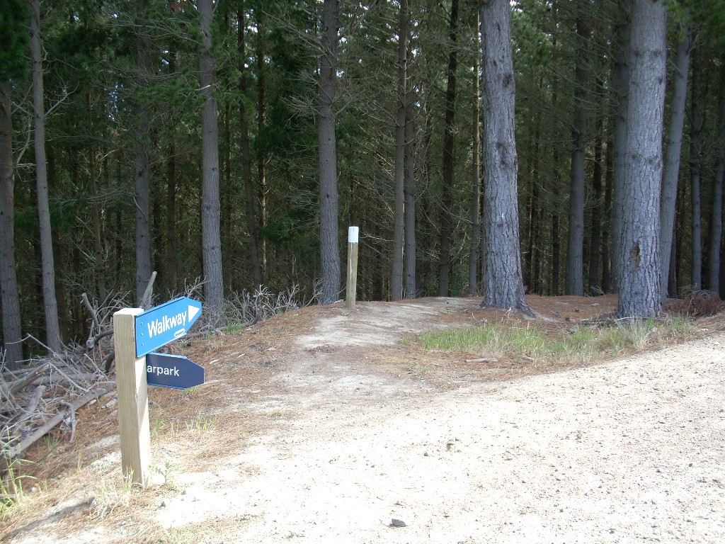 Then later, they planted this managed forest block and very little, if any, of the previous inhabitants had returned. The trees with around two feet across at the base and had obviously been growing for some time. There was some undergrowth. A fern here and there in the middle and a few other plants but, for the most part, the gound beneath the trees, other than being deeply blanketed with needles, was bare.
I wondered if the underground fungal mycelium connections that so many forests have as an integral part of their biosystems was operational here. I imagined the various animals I would expect tobe present in a similar forest in the U.S.’s Pacific Northwest. New Zealand didn’t have any mammals other than a few bats when man arrived so they never were here. Just birds and marsupials. And now the inappropriately introduced Australian Possum which has become a plague on the place. It was a quite and empty place to walk through.
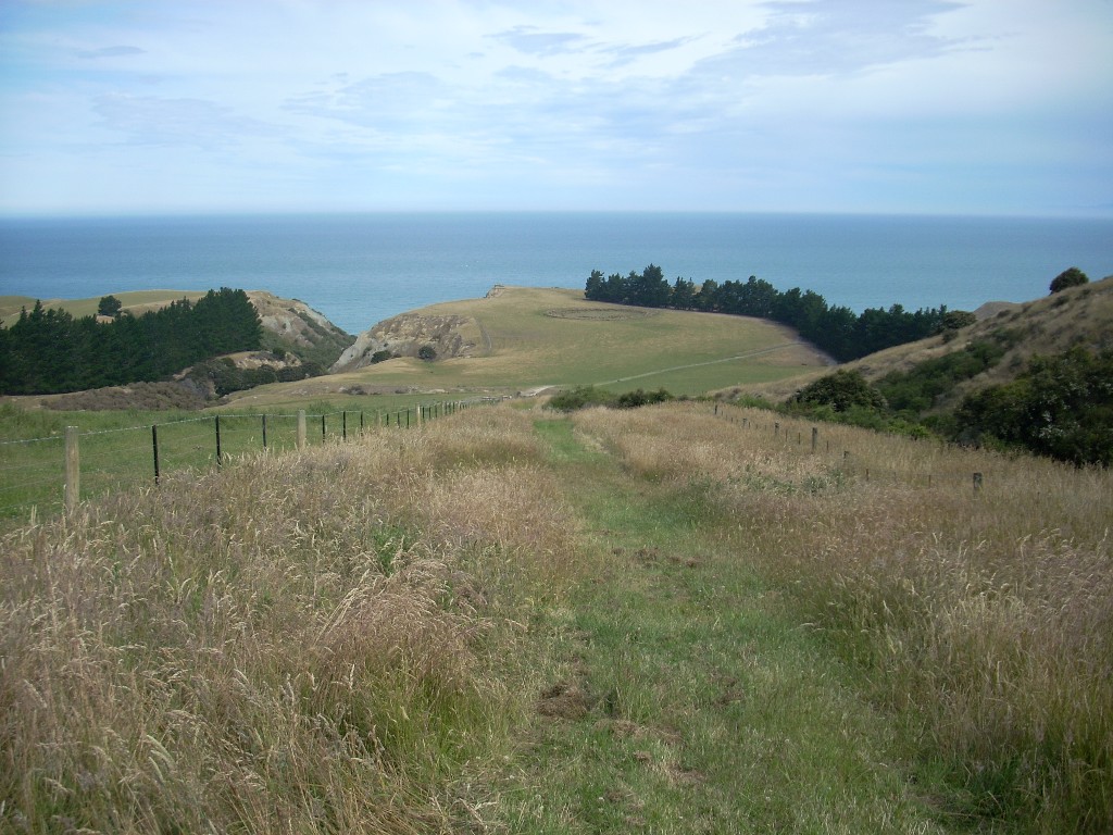 On the other side was a broad sweep of grassy open space trending downhill and now I could finally see the ocean that I’d
 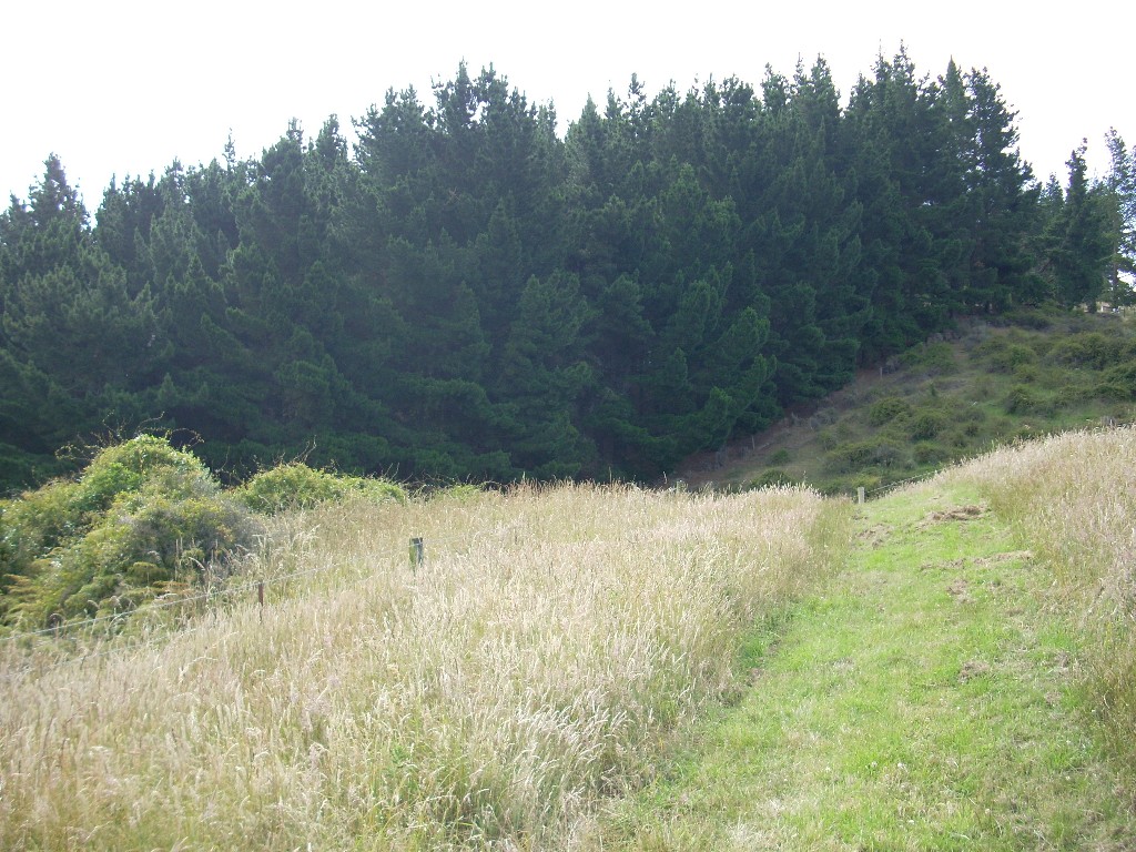 been hearing for some time. Still continuing down hill I proceeded.
I was beginning to think this was a rather longer hike than I’d imagined and I was getting a bit worried by the long decent I was making. I was musing to myself that I was already thirsty and hot and there was no water to be had – short of that I’d find once back on my motorcycle and into a town. And I was reflecting on the fact that I was out at the ends of the earth in an area that might well not be visited by anyone until after New Years. And I was thinking about the long climb back up to the parking area and that while I’m in good shape for an old guy of 60 – I’m not indestructible. It was at about 900 feet in elevation where I’d parked my motorcycle according to my GPS and if I went all the way to the beach, well, I’d obviously be 900 feet lower than that – before i turned around.
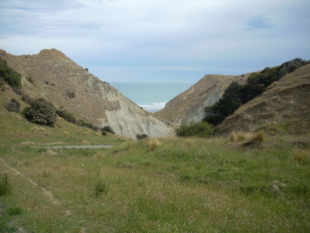 I came around yet another curve to see the next view after a rather long and steep downhill section and I could now see the beach below clearly through the valley’s gap. I thought it was still quite a ways down. The GPS said I was at 198 ft elevation – and I paused to reflect if I really needed to get to the beach that badly. My knees said, “No”.
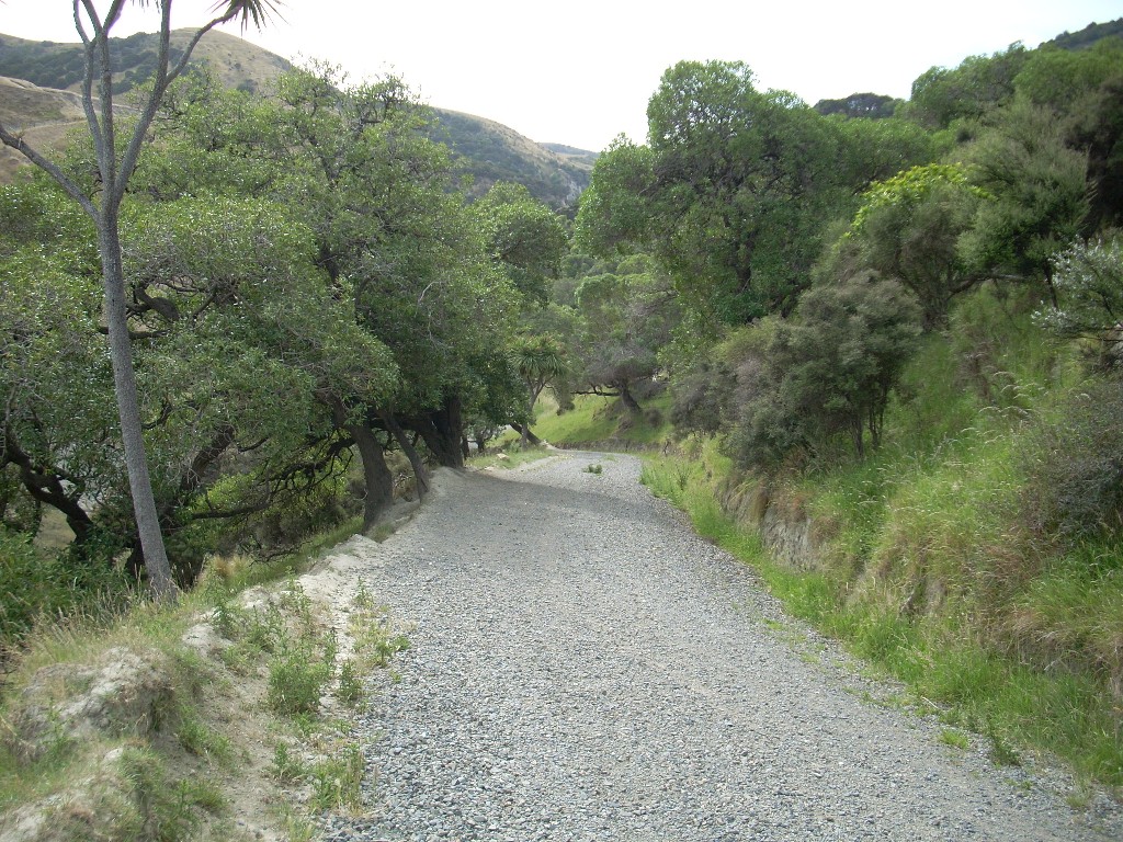
So, I turned around and headed back up. And, it was, if anything, tougher going than I’d imagined coming down. Little steps, trudge, trudge, trudge. Heart rate up, hammer, hammer, hammer. No higher a rate than I run it during aerobics classes but still, not a lot of fun to be had when you know water’s a long ways away and there’s a lot a trudging and patience yet ahead of you.
 The sky to the south over Christchurch was getting grayer and I recalled being told earlier that rain was due this evening. It was nice though, as the sun disappeared and the breeze blew cooler which made the going a bit easier.
I rested in the forest block and played with my GPS (thanks, Alicia!).
Then, recovered a bit, I began again. Up through the forest block and out onto the gravel tracks that snaked up and through the hills. Sheep were here again. 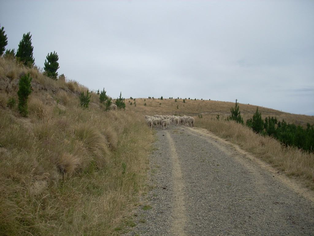 Most of them too lazy to get off the road, were content to walk ahead of me as if I was driving them somewhere. I had a great view of a lot of sheep butts for a long time.
Occassionally, one would get involved eating on the side of the road and forget me and then when I was just a few feet away, it would discover me and make a mad flight from the ‘monster’. Ha!
They said “Baaaa” and I replied, “Baaaa” as well and a few times I slapped my wet floppy hat on my leg and said John Wayne-like things like “Hee-ya” and “Get-along-there”, to let them know who they were messing with. All in all, I think we had a good time – and it passed the time and we went up and up and up.
Finally, the hill with my motorcycle on it appeared and when I crested it and the motorcycle was actually still there, unmolested, I breathed a big sigh of relief. It would have been a very long walk to anywhere to tell folks my motorcycle was gone and I was stranded.
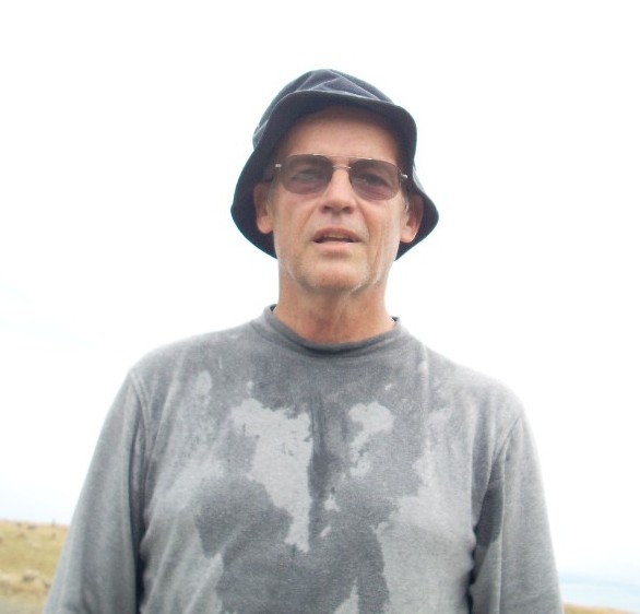 I setup the camera to catch an image of this fool who’d walked off to nowhere all downhill without a drop of water or foresight and once that picture was captured, I got on my iron-steed and rode away. Only one stop between me and home and that was at a convenience store for a pint of cold orange juice. My, did that ever taste good.
So, today, I’ve been to nowhere and back and it was a fair amount of work. So, let that be a lesson to you. <smile>.