 The day I set off dawned beautifully and it set the tone for the five days I would be out. And, on the sixth day, when I was safely home and warm – it rained. I’m a lucky man, no doubt.
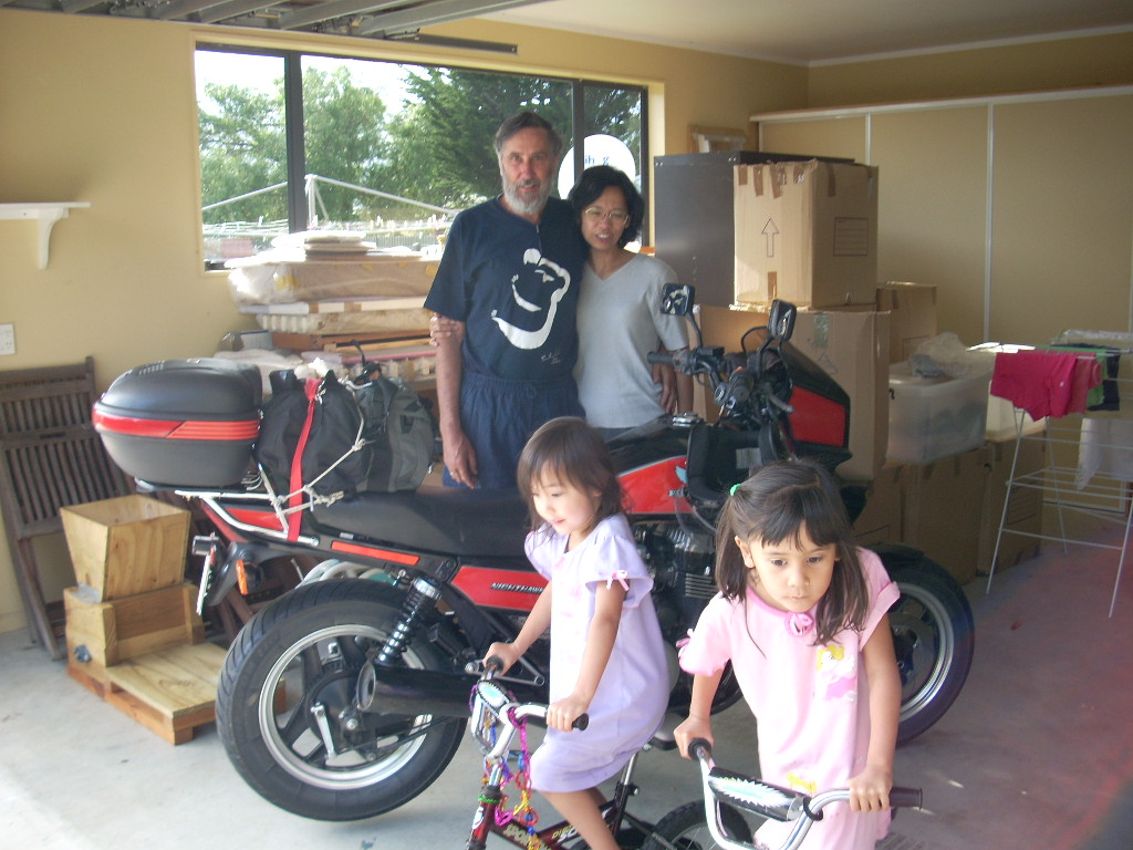
 There were two purposes for my trip from Christchurch up to Takaka and back. One, was to see my friends, Bob and Cynthia and their two girls; Jenny and Marie. Bob and his family had just moved to Takaka in the last month and I was eager to see their new lives on Golden Bay.
And the second purpose was to give myself more familiarity with New Zealand’s South Island in general.
Sharon and I are looking for land here where we might settle. In fact, we have a specific kind of land we’re interested in and we’ve wanted to get clearer about which parts of the South Island might be good candidates.
I still remember the shock when we came over in August of 2006 for a look around.
I’d read for sometime about the heavy rainfalls and the temperate rain forests that exists on the western coast of the South Island. One day, we drove over to Greymouth on the west coast and then down the coast to Hokitiki. It wasn’t all all like what we’d expected. I haven’t seen Sharon cry many times – but she cried that day from the disappointment of it.
You see, temperate rain forests in the Pacific Northwest of the North American continent are coniferous rain forests full of large tall evergreens such as populate the Olympic National Park in Western Washington State and, indeed, much of the area around Seattle. We’d lived for ten years at Echo Lake 35 miles NE of Seattle in the midst of such a forest.
I’d essentially promised her that the South Island’s west coast was going to be a lot like what we were used to.
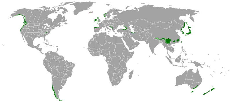 But temperate rain forests in new Zealand are of the broadleaved rain forest type and they are a completely different type of forest. This map shows the distribution of temperate rain forests on the Earth.
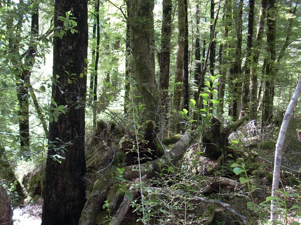
The broadleaved rain forests are lower and the tress are smaller and there’s a lot more underbrush. In fact, along the portions of the west coast where we drove, Greymouth to Hokitiki, I would have called what we saw tall scrub rather than low forest. I think the hard weather along the coast drives it down to hug the land. Regardless, it was a big disappointment which came about because of an assumption on my part. The assumption that all temperate rain forests world-wide are the same. Wrong!
I also learned that night in the Greymouth hotel as I studied my error on their Internet computer, that the broadleaved type of temperate rain forest, such as exists in New Zealand, is the newer and more dominate form. And that whenever the two types of forests collide, the broadleaved will dominate and drive out the coniferous eventually.
So, almost a year and a half later, here I was in New Zealand again and this time I had wheels (my trusty motorcycle) and I was off to see where the Kiwis are hiding their best forests.
Much of the Canterbury Plains that comprise the mid and eastern side of the South Island are borderline dry. This results from the rain shadow effect of the Southern Alps which extracts most of the water from the roaring forties weather as it relentlessly comes in from the west.
Population increases and more and more demand have brought the plains to the point where if the New Zealand authorities don’t intervene and control the remaining resources and establish equitable systems to share the valuable water resources here, there will be problems. Already some areas are reporting dry wells and conflicts over limited water resources. And that would be a shame as these plains are essentially New Zealand’s bread basket area. They serve much of the same function that the midwest plains do for the U.S. and Canada.
So the beginning of my ride from Christchurch up through Amberly, Waipara, Waikari, Hurunui, Culverden, Marble Point and along Highway 7 to just prior to Lewis Pass was through open and generally treeless land best used for grazing.
After Marble Point, there was a very long stretch of nothing until I got to Springs Junction. No towns at all and very little sign of habitation other that the odd flocks of sheep grazing on the hill sides. It gave me a scare because I’d been quite cavalier about buying gasoline. “It’s a small island.“, I thought – “How bad can it be?”
Well, in fact there are some long bits of road with nothing along them out there. Not too surprising when you consider there are only one million people on this entire island. But, I needn’t have worried. My motorcycle, which normally gets about 30-35 miles to the gallon around town, was getting about 50 miles to the gallon out on the highway running along in overdrive so I still had gasoline and hadn’t even had to switch to reserve by the time I reached Springs Junction. But the entire last twenty miles, I could hear my wife whispering in my ear, “I told you so, Gally. You never buy gasoline early enough.”
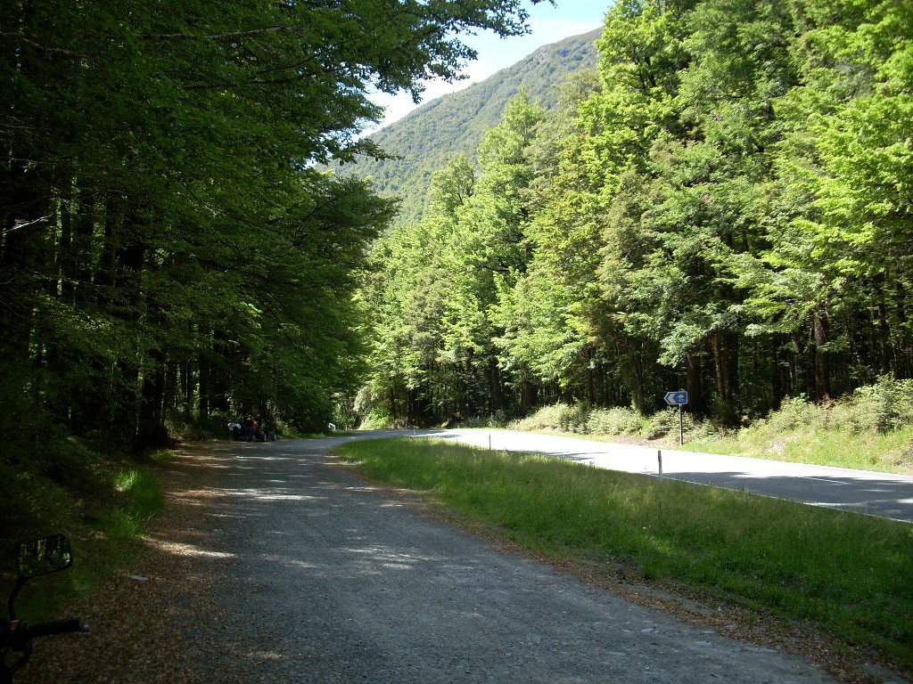
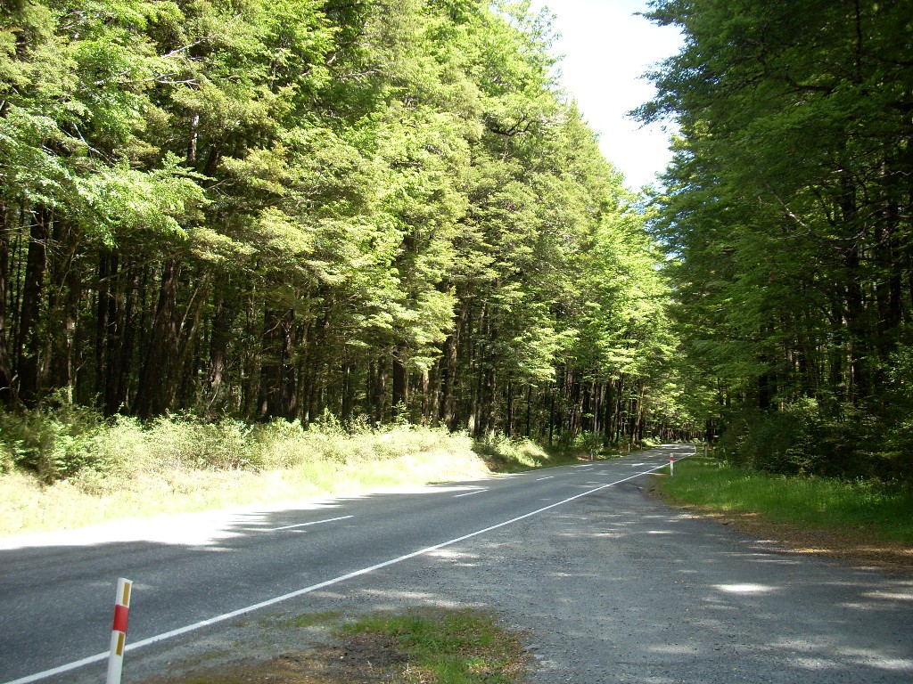
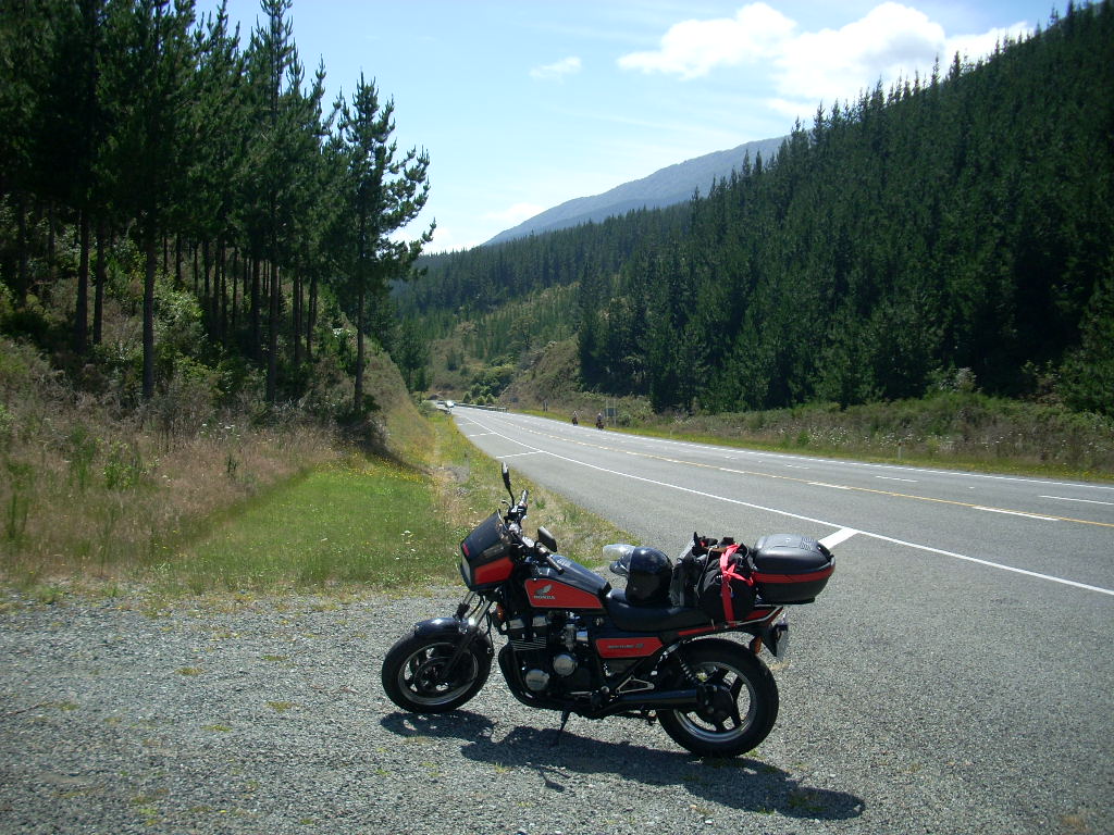
Going over Lewis Pass (which was some distance before Springs Junction) at about 3000 feet (915 meters), I could feel the cut of the cooler air on an otherwise warm day. And, about 5 miles past the pass, I found the first bit of forest that I wanted to stop and photograph. For those with GoogleEarth and and an understanding of GPS, we’re talking here about 42d25.7m S by 172d17.8m E.
I filled up in Springs Junction but I had to give up on the one place in town to eat as they had a line out the door. So I rode on north towards Murchison.
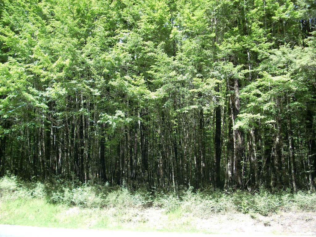
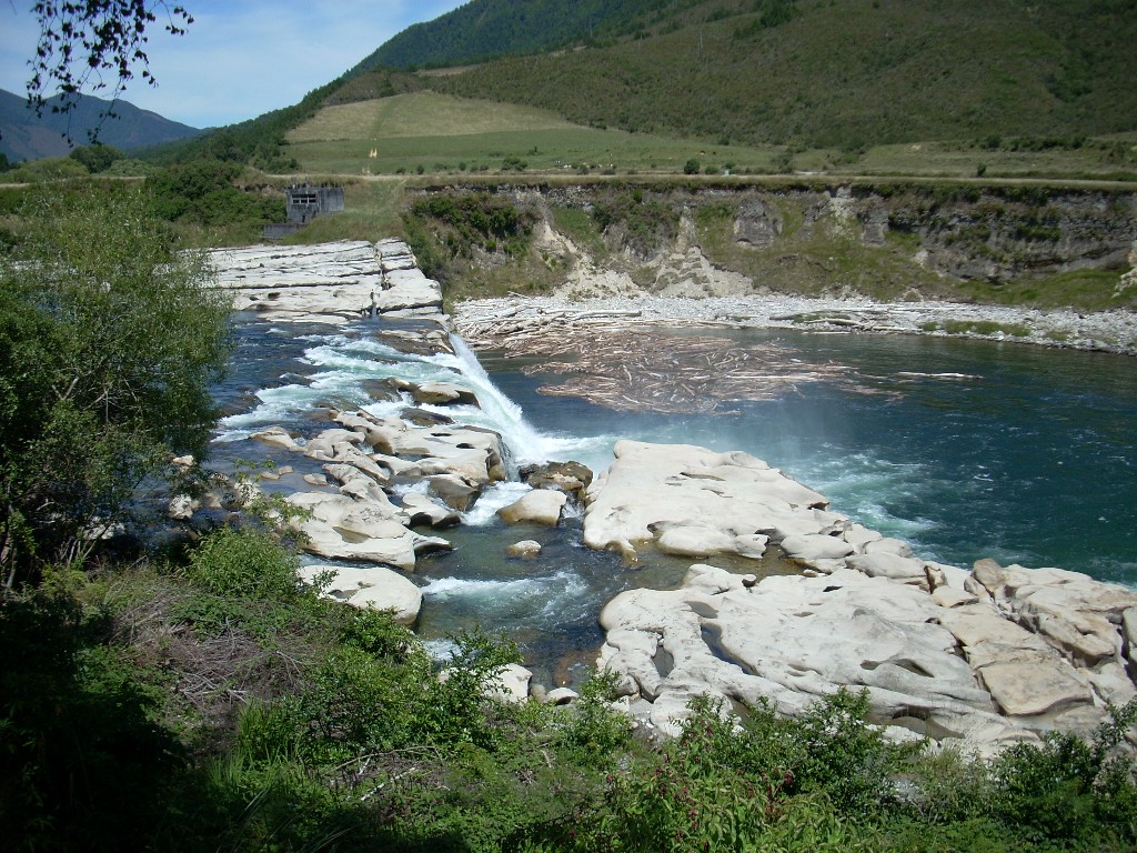 The countryside from Springs Junction to Murchison was pretty. Some forests, some open, all green. I stopped and photographed Mauria Falls along the way.
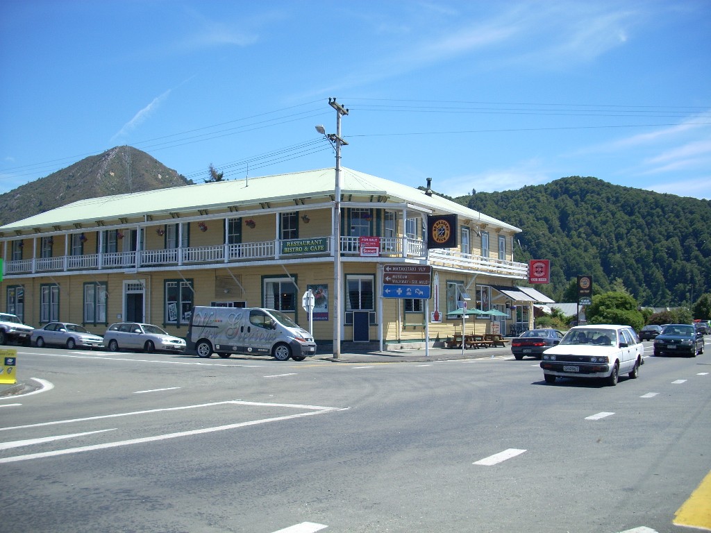
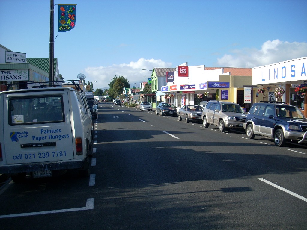
Murchison is a pretty town. It had been particularly recommended to me by a few people when I told them I was looking for forested areas. I stopped there for lunch and took a few shots. In general, I liked it – but it is a long ways from any place of size.
I continued north from Murchison and the country got prettier and prettier as I went. The road ran along through long valleys and then up and over small ranges. Everywhere I saw trees and forests or open valleys full of farms and grazing lands. 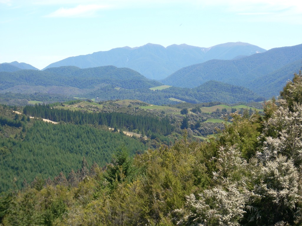 I passed through Owen Junction, Glenhope and Motupiko. In Motupiko, I turned off of Highway 6 which I’d been following and headed north on the Motueka Valley Road that would eventually take me into Motueka on the coast of the Tasman Bay.
 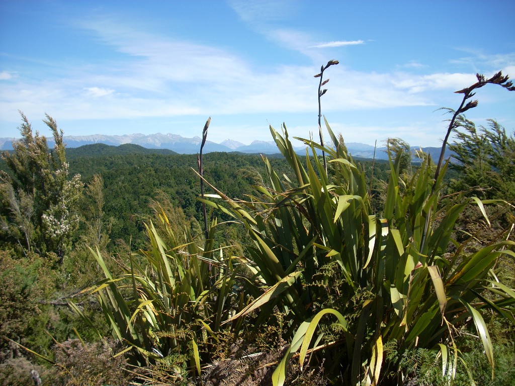 I stopped and shot photos at several locations including the Hope Saddle and a beautiful place in the Motueka Valley.
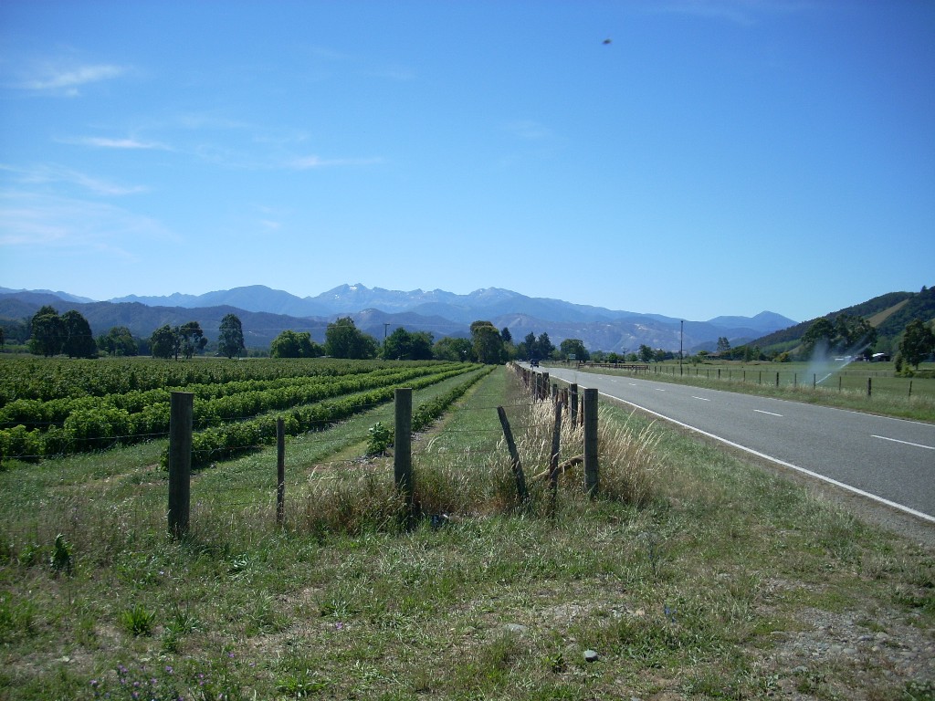
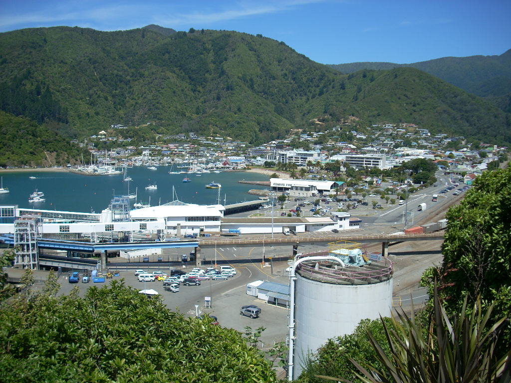
Motueka was an interesting beach town. Busy and full of holiday makers. It reminded me of some California beach towns in the summer. I filled up with gasoline in a very busy station on the main street and then headed off again. At this point, I was getting close to my destination, Takaka, and I was worried a bit about the time because I’d stopped so many places to gawk and take pictures I knew I was going to miss my goal of being at Bob and Cynthia’s place by 6 PM.
Beyond Motueka, to get to Takaka, you have to go up and over Takaka Hill. It’s a steep and tortuous climb. Fun on a motorcycle but dangerous also. Everyone has a different idea about how fast to drive a road like that. And every blind curve with the motorcycle laid far over could contain a life-ending surprise if someone makes a bad judgment. Needless to say, my attention was largely riveted on the road.
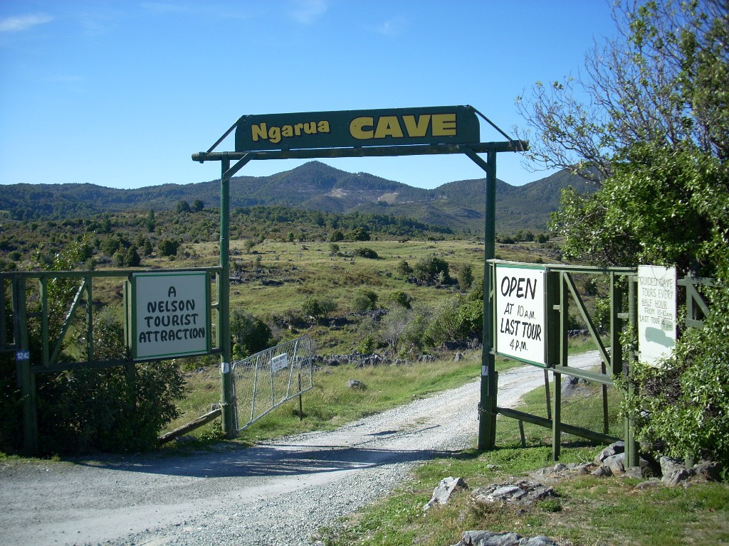 But no so much that I didn’t see some beautiful sites. This area is largely limestone so there’s a lot of caves here and near the top of Takaka Hill is the Ngarua Caves and viewpoint area. I stopped and shot a few pictures here. it was too late to take the caves tour and time was pressing me anyway.
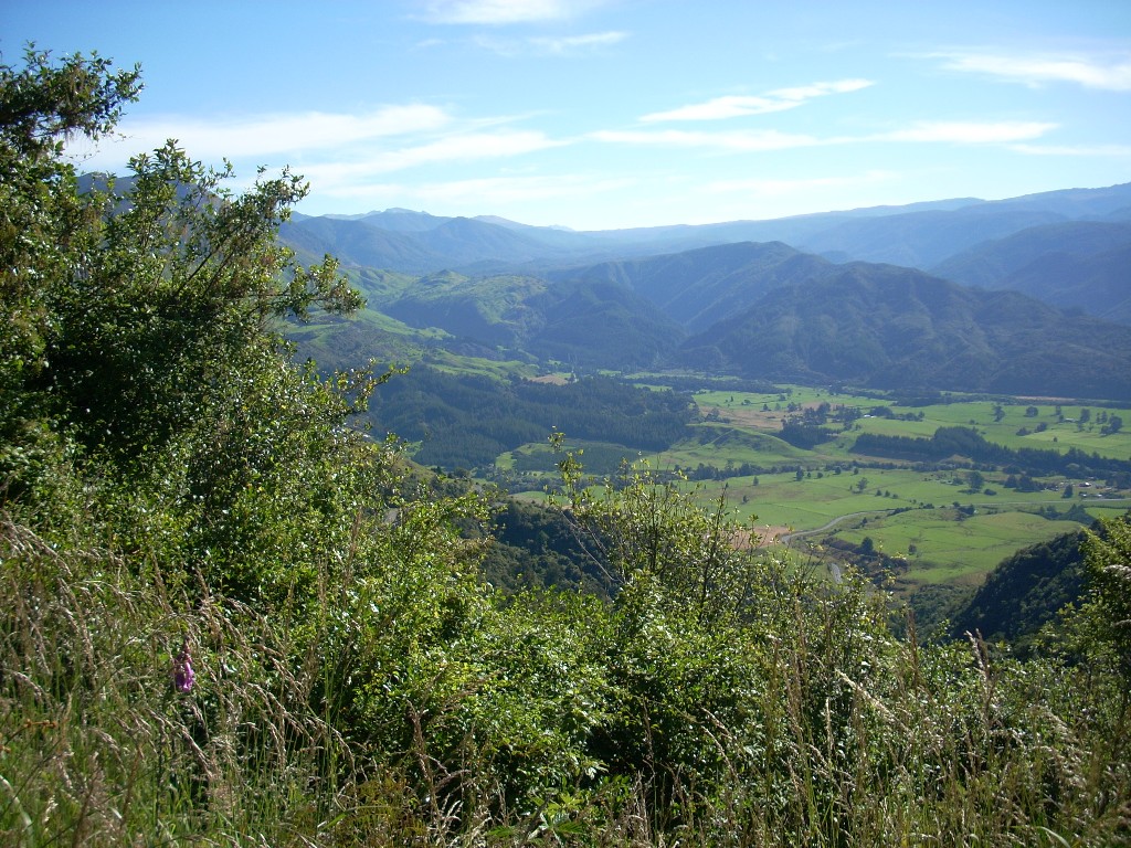
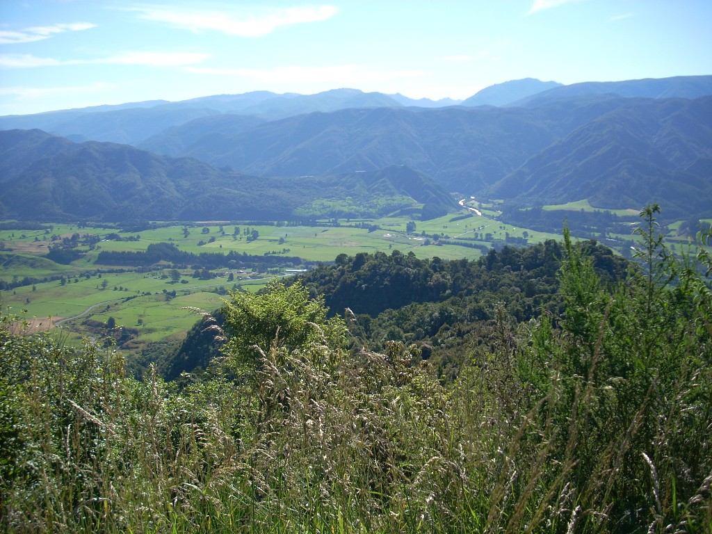
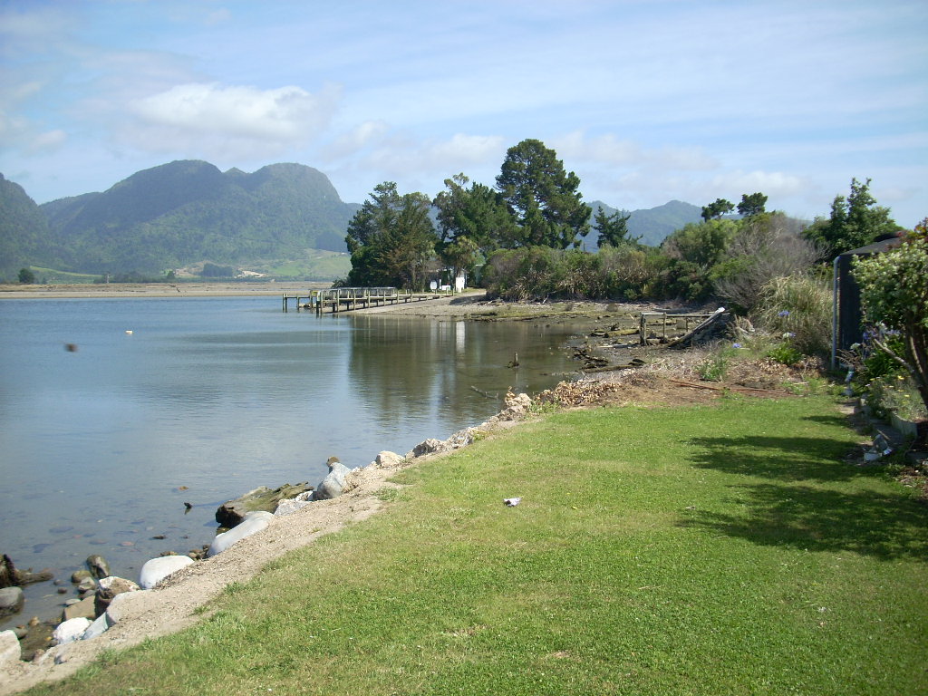
After the Ngarua Caves and viewpoint area, I continued down the back side of Takaka Hill and into the Takaka Valley. The valley runs straight north and terminates in Golden Bay which, itself, opens off to the west from the larger Tasman Bay. To the east of this valley is the famous Abel-Tasman National Park. And to the west lies Kahurangi National Park.
Interestingly, the last place in New Zealand that really cries for a road to connect two areas lies here in the northwest corner of the South Island through the Kahurangi National Park. There is no way to go from Takaka or Collingwood over to the west coast except to drive far south and then around to reach Karamea. This reminds me of the Darien Gap along the Pan-American highway. Folks tell me that they doubt the government will ever run a road through this area so Takaka and Collingwood are likely to remain paradises at the end of the road; like Karamea is on the west coast.
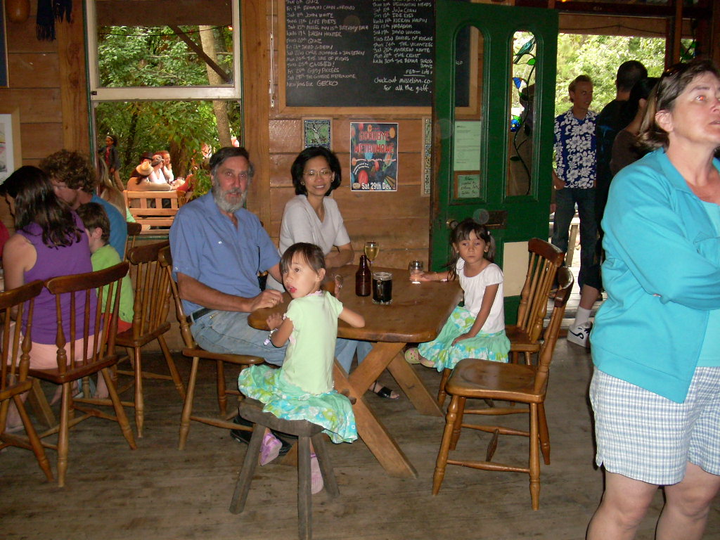
I arrived at Bob and Cynthia’s place on Wednesday just before 7 PM and just in time to join them for a bite to eat which was beautiful timing.
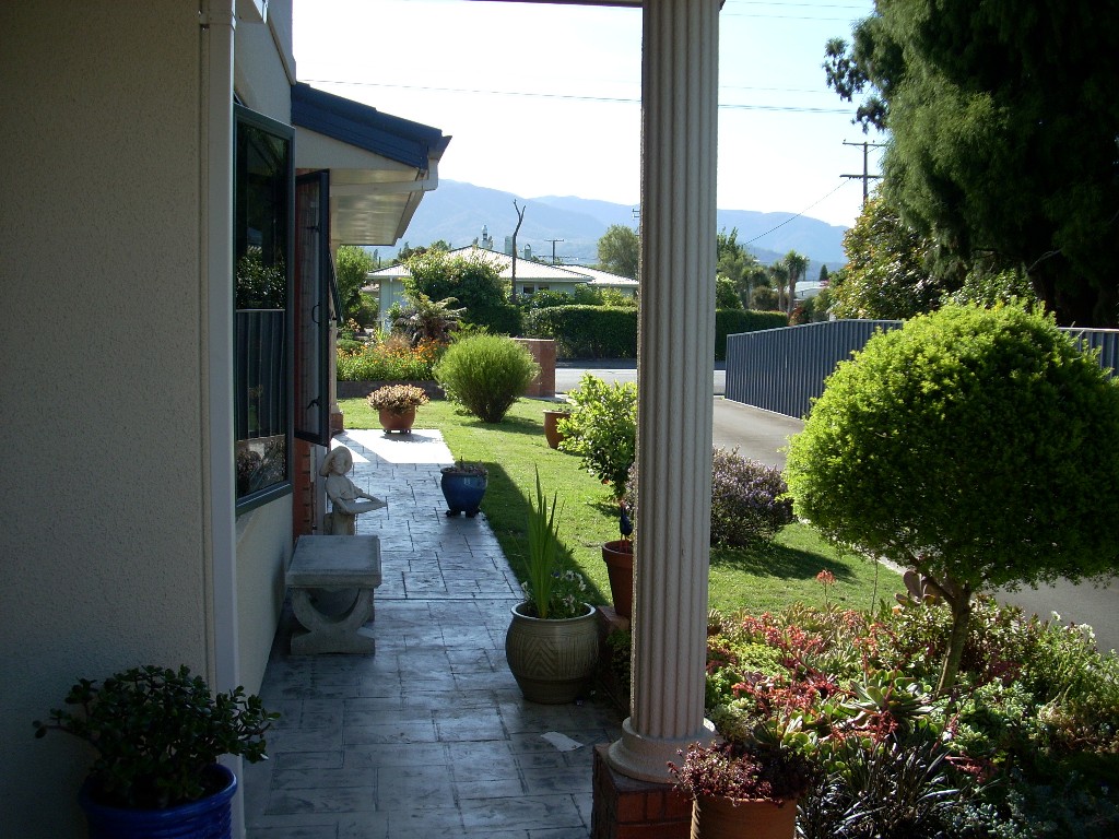
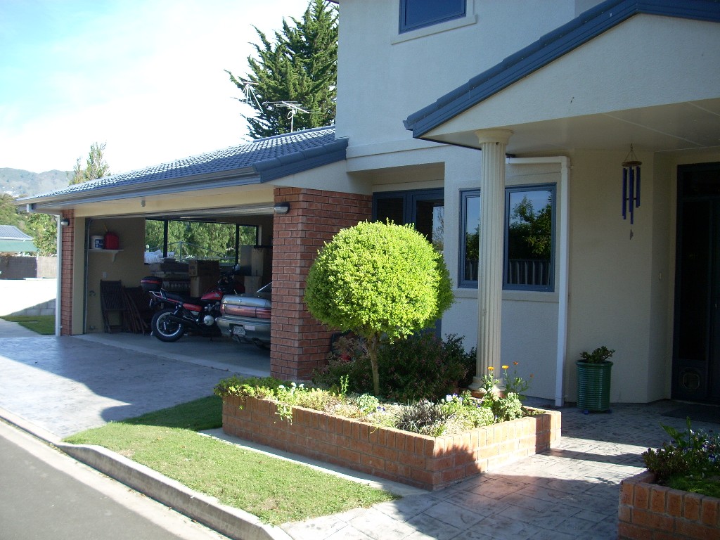
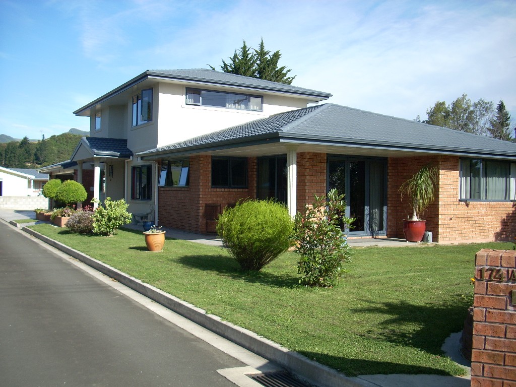
They were very lucky with their rental in Takaka. The property they bought just outside of town doesn’t have a house on it so they will be building one and just by good luck and timing, they managed to rent a newly constructed house right on the main street in Takaka. It is a beautiful place with big-screen TV built into the wall and lots of space and cabinets and a bathtub big enough to go boating in.
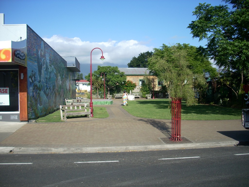
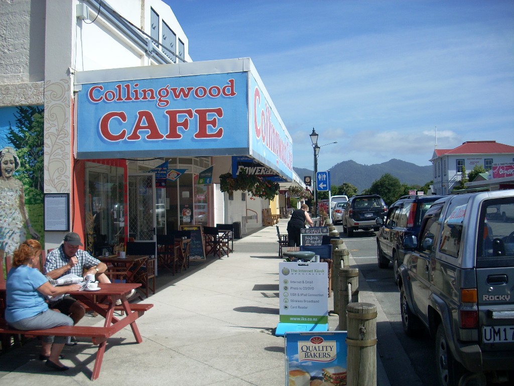
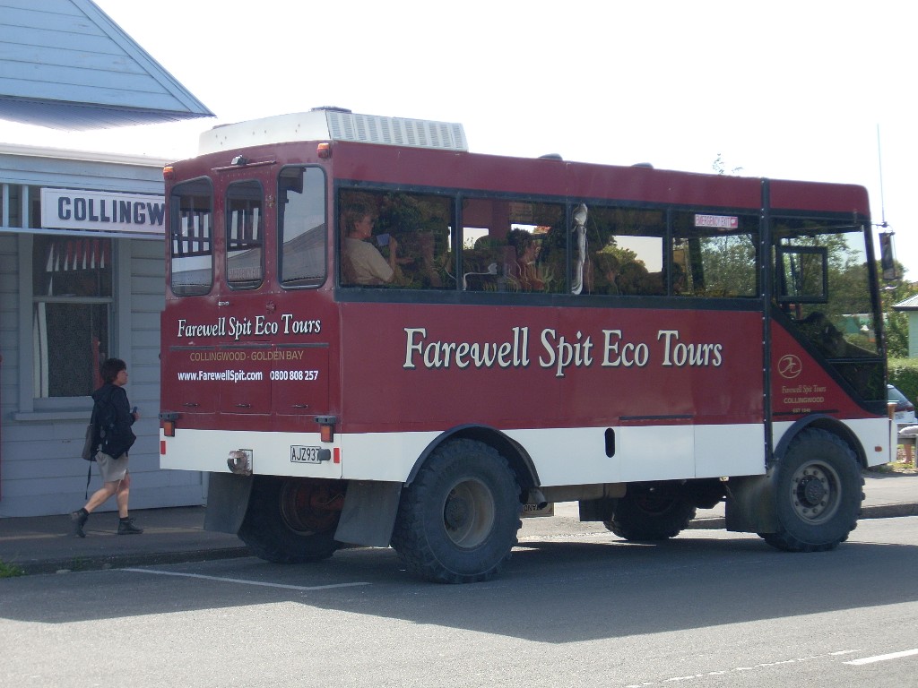
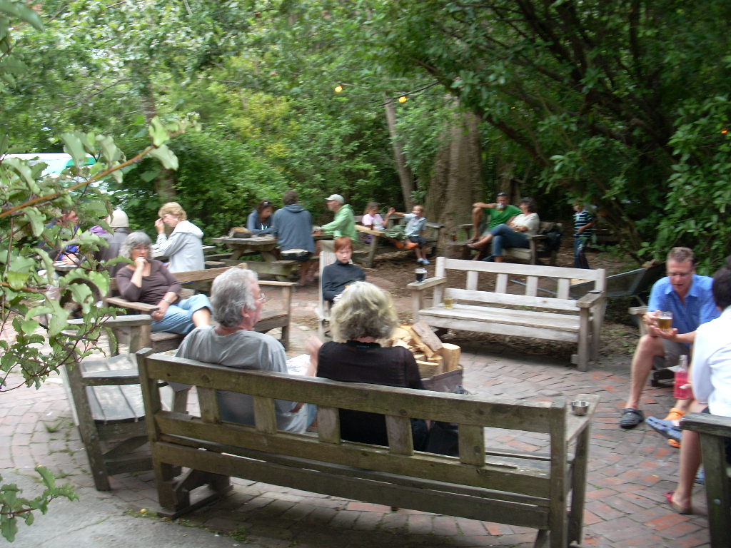
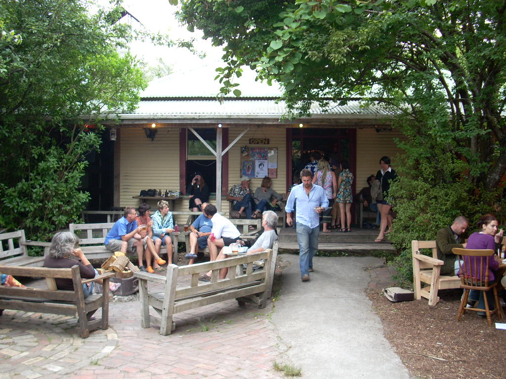
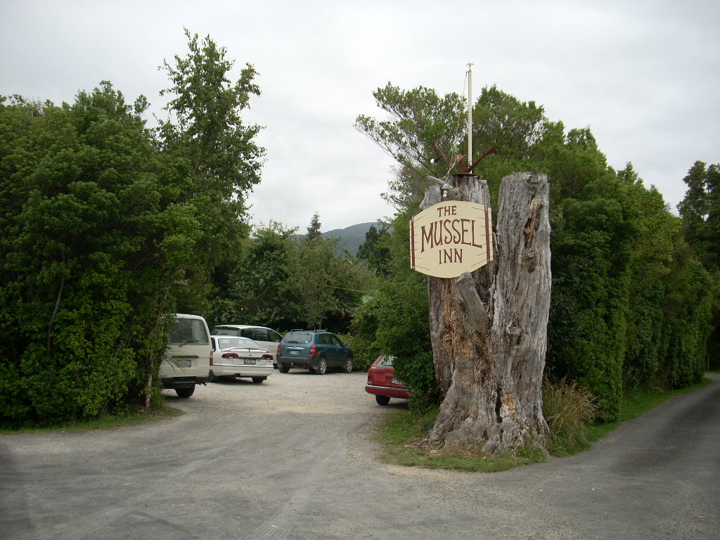
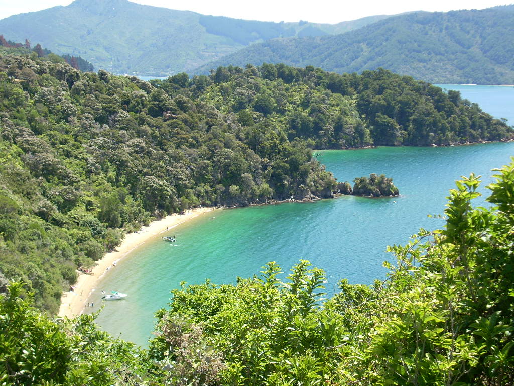
The next two days were spent visiting their new land outside of town, going to the beach at Ligar Bay, eating at Mussels (a famous local eatery) and in talking about the world, politics and environmental problems. Also, on Friday morning, I took a short ride up to Collingwood to have a look around.
Bob and I spent time on their property walking about and taking GPS readings to generate a data set that he could compare with the manual surveying he’s done so far.
Their property has a good deal of slope to most of it and it is heavily forested (bush, as the Kiwis say). There’s a nice year-round stream that runs through it with a large elevation drop so it is possible they will be able to generate their own power in addition to obtaining their water supplies from it.
I learned the names of the three types of trees that predominate on their land. They were the Tea Tree (Australian) or the Manuka Tree. The Rimu Tree and the Punga Tree Fern.
Bob told me that the Takaka area gets more than six feet (72 inches) of rain per year. Here’s a list of the U.S.’s ten rainiest cities:
Note that Seattle, my home city, didn’t even make this list with an average of 37 inches of rain per year. And Christchurch, here in New Zealand, only comes in at about 17 inches per year.
 My two days with Bob and Cynthia were soon over and on Saturday morning, I gathered my things together and prepared to set off for Kaikoura. Bob’s got months and months of work ahead of him to clear and survey the land and to get a house built on his property and I’m really looking forward to my next visit to see how it is all coming along.
From Bob’s place, I went back over the Takaka Hill again. It was a nicer ride this time and I did the entire length of it with nary a car on my tail or in my way. I dropped down into Motueka again and passed through it and this time I took the road south (Highway 60). I’d arrived in Motueka two days earlier on the Motueka Valley Highway from the west.
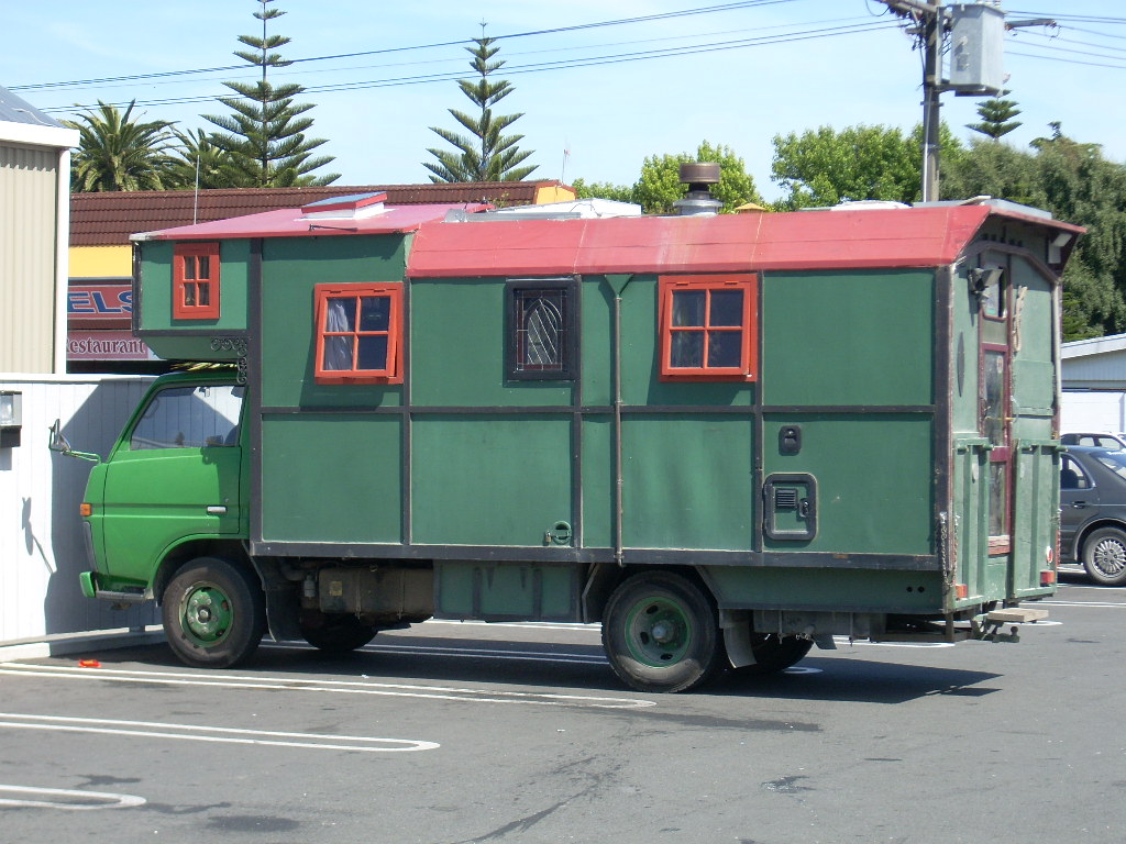 Highway 60 works its way around the southern part of the Tasman Bay and it passed through Richmond and then Nelson. I’d particularly wanted to see Nelson having heard so many nice things about it. I stopped there and grabbed a bite in a McDonald’s (yes, they ARE everywhere). There was a home-brew New Zealand RV in the parking lot that I shot a picture of.
Nelson is reputed to be one of the best places to live in NZ in several respects. It is sunny and it has a nice laid-back artistic counter culture feel to it. I’m sure all that’s true. But, to me, the expensive houses gathered in the sun above me on the hill sides reminded me of what Laguna Beach and much of Orange County in Southern California have become a little more than I liked. The consumerist beach culture felt strong and, as I reflected, I realized that the laid-back artistic feel I picked up in Takaka appealed to me a lot more than what I was seeing around me in Nelson. But, its all just a matter of what appeals to a person and that’s just one person’s take on Nelson.
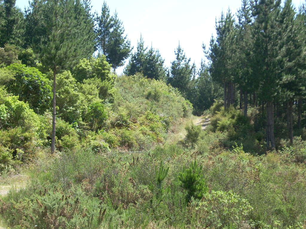
McDonald’s meal aboard, I drove on east and soon the road turned into the interior as it began to work its way east towards Picton. About 20 km outside of Nelson I stopped at about 41 12.6 S and 173 27.8 E and took some photograph. All along here it was hilly and forested, Endless green in all directions for a long long time. In the end, it stretched like that all the way over to Picton. These photos are just of one sample along the road.
Small places like Rai Valley, Pelorus Bridge and Canvastown passed beneath my wheels as I rode through the endless forests and hills and finally I came to Havelock and the beginning of the many islands and sounds that make up much of the South Island’s northeastern corner. A boater, a hiker or a bike rider could lose themselves for weeks in this corner of the island and never see it all. It’s not unlike the San Juan Islands along the coast north of Seattle in the U.S. – except that here the population density is quite low and the waters are warm. An amazing place.
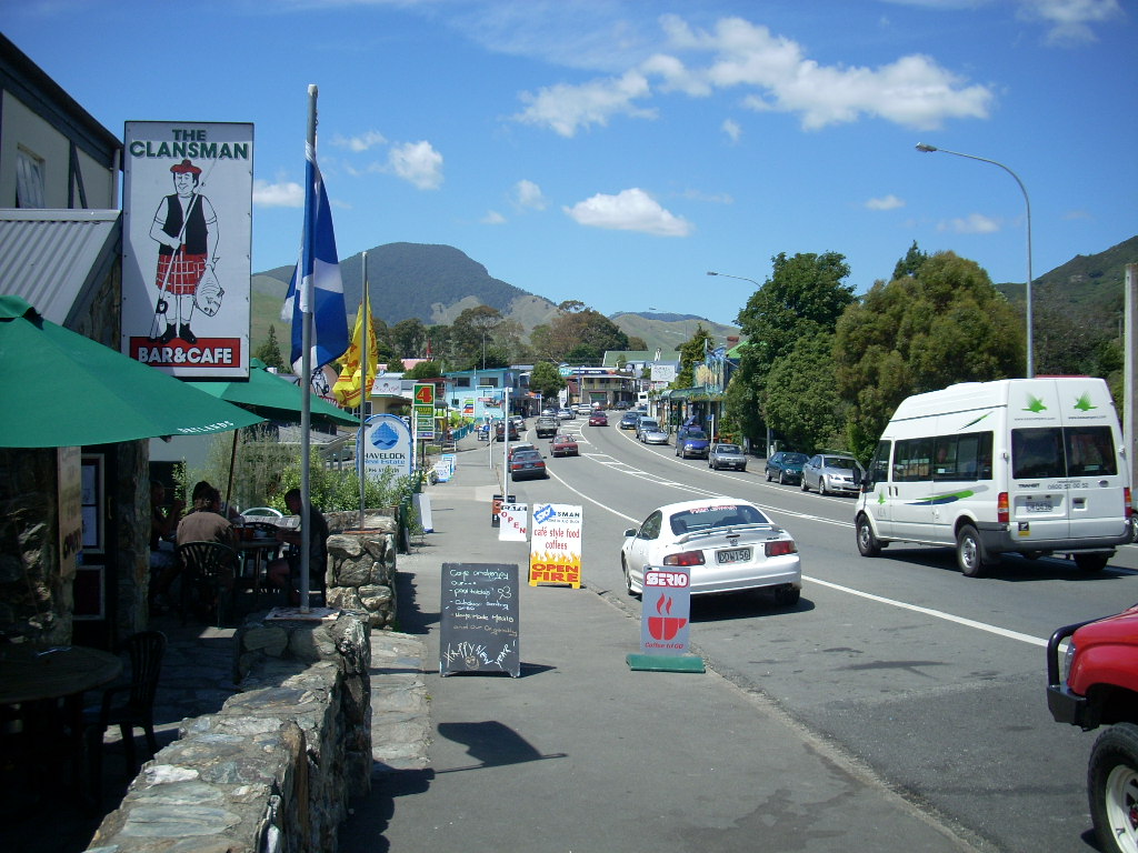 In Havelock, I decided to stop for lunch and I was tempted by a place called The Clansman Bar & Cafe. There was a good place to sit outside and keep an eye on my motorcycle and see the town and enjoy the weather. In Havelock, mussels are the thing.
 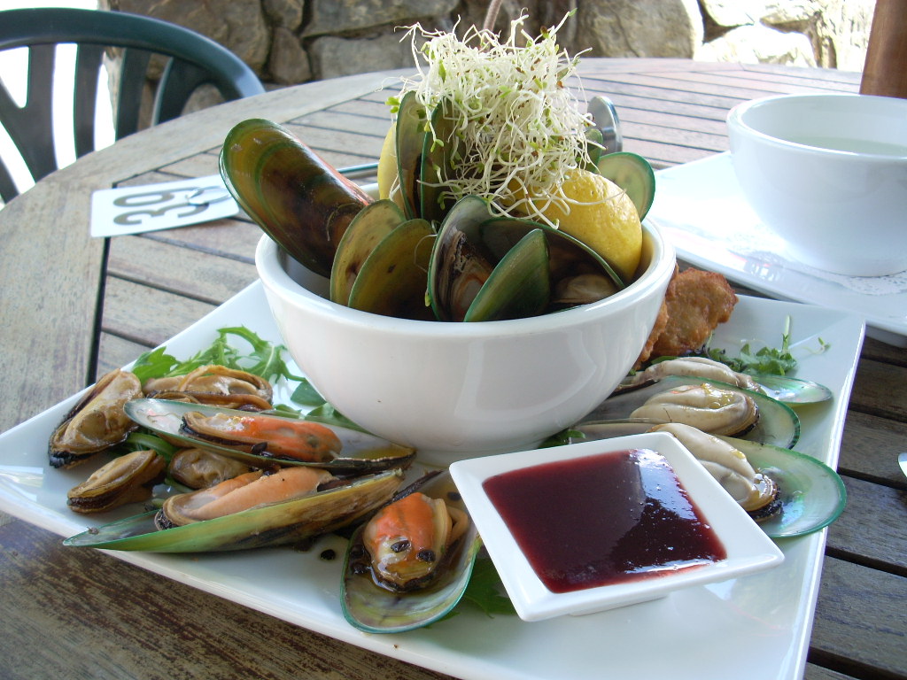 When the waitress came out I asked her what the best thing might be to order so I could sample the mussels and she suggested ordering the half platter – which I did. And when it arrived, I was not disappointed.
From Havelock, I continued east along the Mahakipawa Arm and then inland again for a bit until I came out long the beginnings of the Queen Charlotte Sound.
I stopped two places along here. The first was a lookout over the Sound. 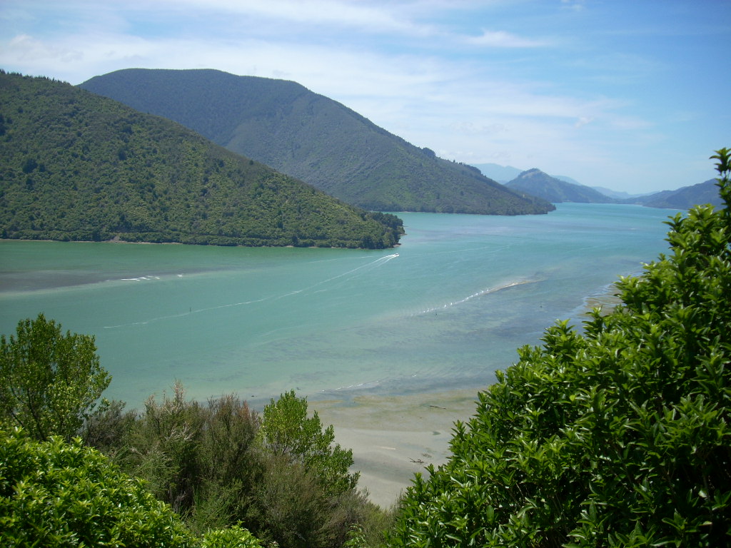 I met some American motorcyclists there and we chatted for a bit and I shot a picture of one couple with their ‘Trike’. They had come to NZ and rented their motorcycles here. They told me that they’d come that morning from Kaikoura where I was heading and that the place was packed and not a room was to be had.
 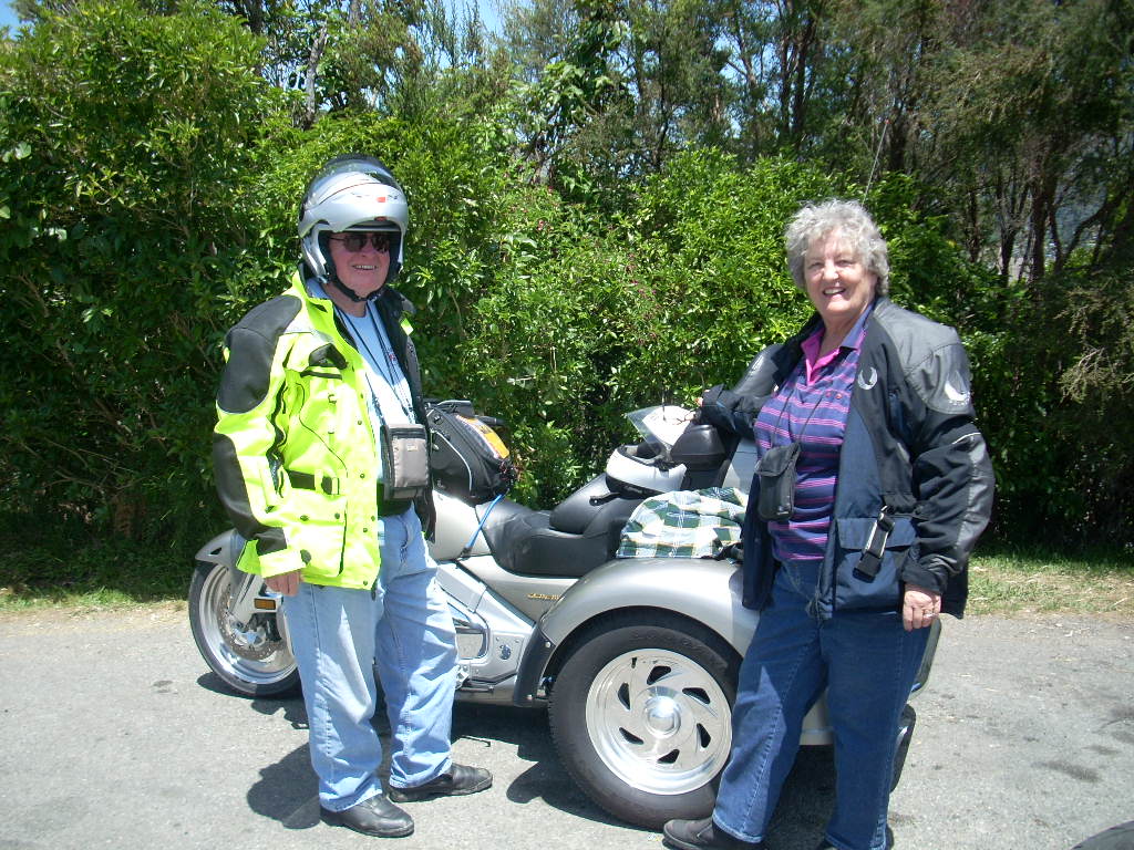 I was going to be arriving on Saturday evening in the middle of what Kiwis call the “Silly-Season” when everything virtually shuts down and everyone goes on vacation. It made me wonder if I would be able to find a place to stay in Kaikoura that night.
I continued on and someplace near Ngakuta Bay I stopped again to have a look around with a big view. There was a blond woman bicyclist there eating her lunch and I said ‘Hi’ as I walked by on my way out to the point to take some photographs. After a few minutes, she wandered out and we started talking.
 We exchanged stories of why we were in NZ. She was Dutch and had come to NZ the first time 20 years ago or so and had loved it. She’d gone back to Europe and lived in several places, including Switzerland, and finally realized that NZ was where she really wanted to be.
 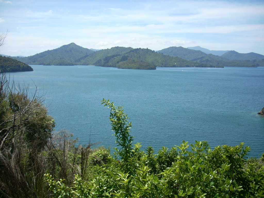 15 years ago, she’s been to this very bay where a fellow had owned a house down below and let her stay as long as she’d liked. Now she was back on a bicycle ride through the area and she was having a bit of nostalgia as she looked down on the bay remembering all of that.
 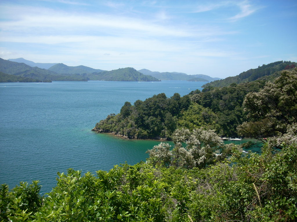 She now lives and works in Wellington and has no regrets that she’s come to NZ. She reminded me of some of the people I met years ago when I was involved with Bhagwan Shree Rajneesh in Oregon at the summer festivals at Rajneeshpuram.
From the last stop, Picton was just around the corner. Picton’s interesting for me because up until Sharon and I flew into Christchurch in August of 2006, Picton was the only place I’d been on the South Island. When I came to NZ in December of 2003 and toured the North Island, I’d found myself in Wellington on Christmas Day with little to do and when I walked down at the harbor, I’d seen the Inter Island Ferry getting ready to depart from Wellington Harbor for Picton on the South Island and, on an impulse, I got on and paid my fare and took the trip over and back just for the hell of it. It was a lot of fun and I was happy I’d done it.
Now I was back four years later and coming at Picton a whole new way.
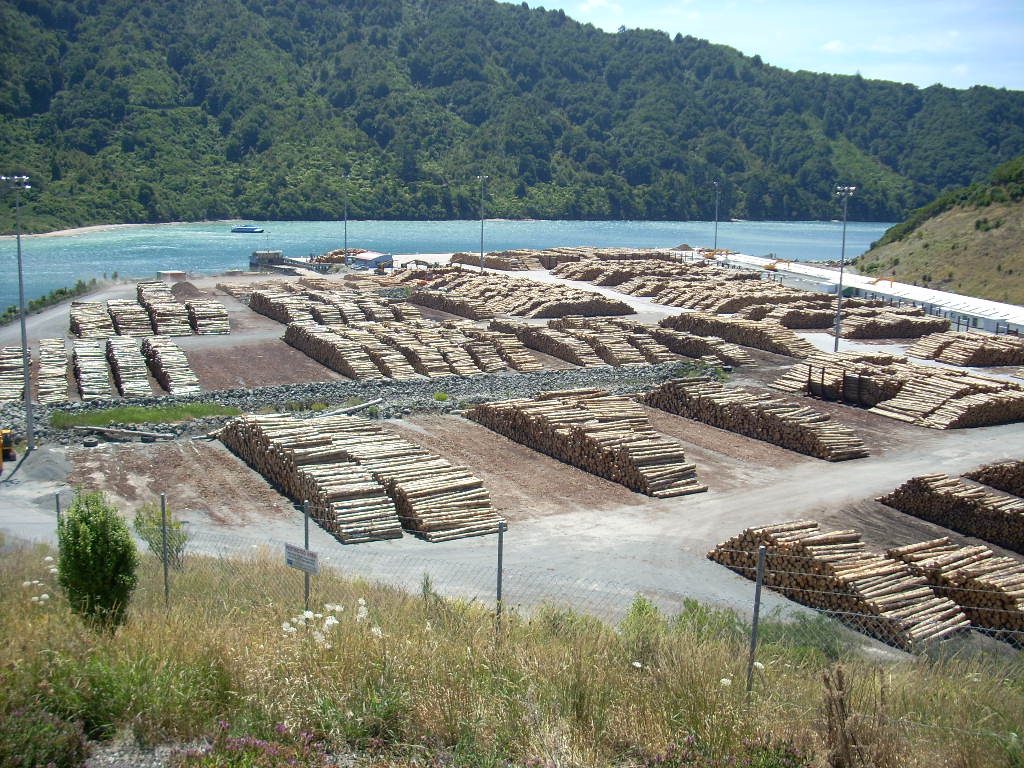 Coming into Picton, I passed a log processing facility and it reminded me that all these many thousands of trees I’d been seeing represented a forest economy as well as great beauty.
Picton is at the end of a long bay that branches off the Queen Charlotte Sound. I remember riding the ferry in and out in 2003 and how there were miles and miles of forested shorelines and the occasional bach and small pier on some of the shorelines. Even on my most detailed map now, most of the shoreline along the sound that the ferry comes in and out of has no road access to it. If someone has a bach out along there, it is likely to have been completely built and supplied by boat.
 The town itself is dominated by the Ferry. It is the prime way for people, cars and rail to move between the North and South Island.
 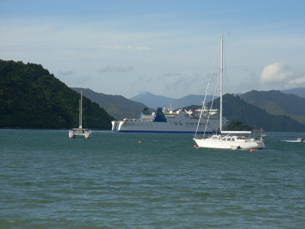 Indeed, the very motorcycle I was riding on had arrived by ship at Tauranga on the North Island (where I also had first touched land) and shipped by rail to Christchurch and passed through here in Picton in a crate in a railway car some weeks earlier. Very strange.
I was worried about finding a place in Kaikoura if I continued on south and so I decided to have a look around Picton and see if I could find a place to stay there for Saturday evening. I took a ride out east of town along Waikawa Road and came to Waikawa Bay. A pretty place with a little beach and a lot of bachs and boats laying about. I found place there that had a vacancy sign up and I rented a room for the night.
Then I went back into town where I’d seen an RSA (Returned Serviceman’s Association) hall and I went in for a beer and to see what was for dinner. The RSA is somewhat akin to the U.S.’s Veterans of Foreign Wars (VFW) system of posts. Last year, in Christchurch, I’d paid my $35 NZD and joined the local RSA. It’s a good way to meet people and it’s a great place to have a beer and a meal at reasonable prices. And when I told them that I’d been in the U.S. military but that I’d refused to go to Viet-Nam, no one seemed to think it was amiss.
So, I went into the Picton RSA got a beer and had a look around the place. It’s bigger than the Christchurch facility I go to. They were going to serve up dinner for $12 (Pork platter) in a bit so I took a table and sat and read my book and idly watched folks. I never ended up talking to anyone there but I was fine with that. A book, a good dinner and knowing that I had a nice place to stay was enough for me.
Later that evening, I drove back out to Waikawa Bay and settled into my place after buying a can of pre-made coffee with creme and sugar already in. Just add hot water. 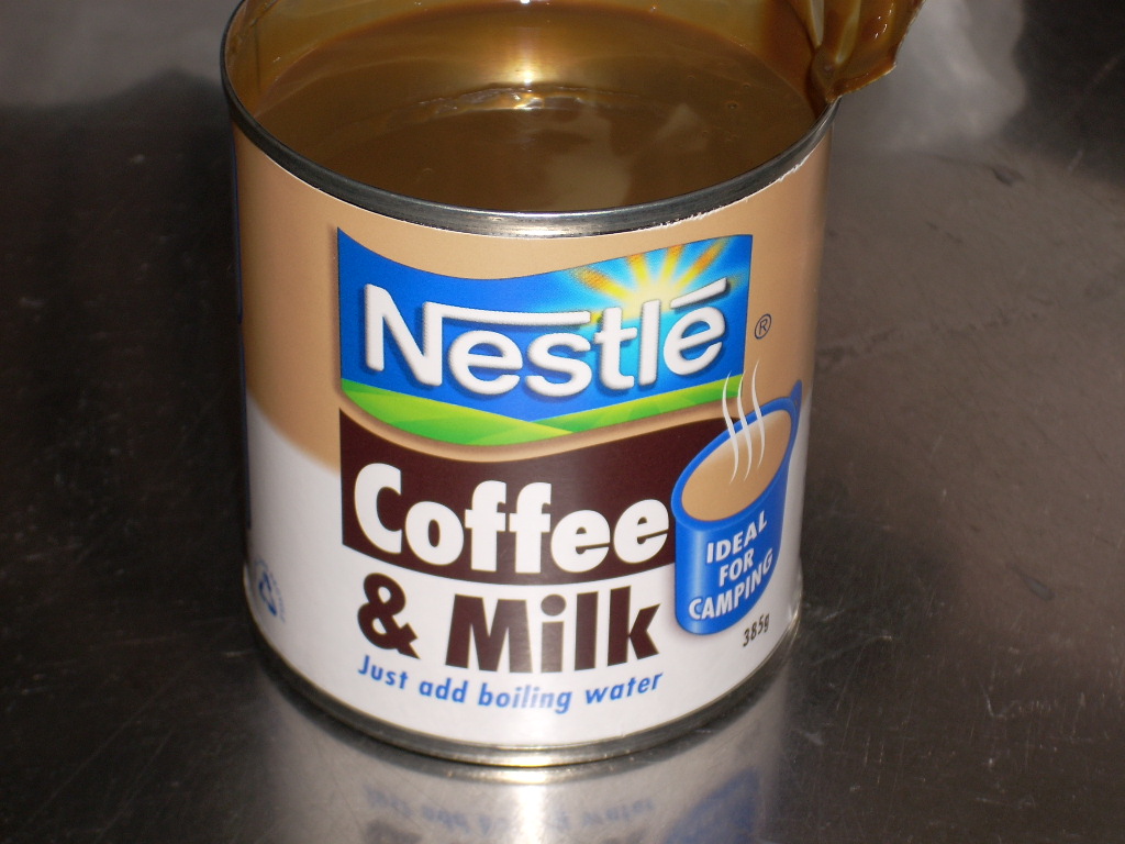 An interesting idea I’d never seen before. I wanted to get up early in the morning and head out and the only restaurant in Waikawa had expensive prices and no guarantee that they’d be open when I wanted to have breakfast so I bought this strange coffee concoction and a box of six apricot fruit bars in Picton. I knew that I could dine on all of this in the morning and be off at whatever time I wanted to go.
The motel had TV with the Sky service on it and I located a movie called “Proof” on Sky that caught my attention. It was a movie I’d never heard of and I loved it. It was about a father and daughter who are both mathematicians and it was very good.
 Later, when the movie was over, I decided to walk out and see what Waikawa Bay was like at night. Beautiful! The sky was crystal clear and the light pollution was low so all of the stars in creation were out and the moon was new and gone – so I had quite a show.
 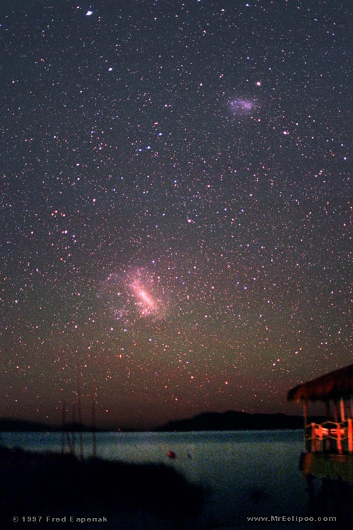 For the first time since I sailed on the Direct Tui from the US to NZ and back in 2003/4, I saw the Magellanic Clouds and the Milky Way as it appears from the southern hemisphere.
I lay back on a concrete picnic table and just looked up at the sky for about 20 minutes. In the distance, I could see the occasional flare of a cigarette and I could hear a couple of people talking softly at another picnic table. A meteor sliced a line of light above me at one point as a stone 4 billion years old burned into dust. The same dust which settles on our table tops and shelves.
In the morning, I ate my breakfast of apricot bars and pre-made coffee and creme and took off – headed south towards Blenheim and Kaikoura.
Once you pass Tuamarina on the way to Blenheim, the countryside flattens out and the intense green of the forests gives way to open countryside. I found this part of the journey boring and when I got to Blenheim, I found nothing much about it to like. It was just another medium sized town on the flat to me. I continued on south through ever dryer countryside.
I remember huge open swaths of land and blazing along at 110 kph with the occasional car to pass or be passed by and the large trucks lumbering along. The hills were low and the curves, when they were there, were wide. On the map there was only this main road south and a few small roads off to the side. Very few towns on the main road (Highway 1 now since Picton) and almost none off the main road. The coast was about five to 10 km east all along this stretch from Blenheim all the way down to Wharanui when it finally joined the coast again.
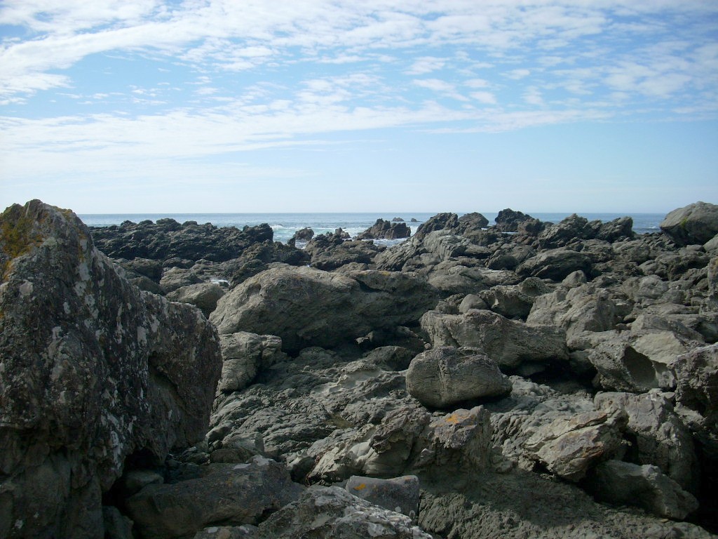
Then there was a long stretch of road along the coast. An empty coast all the way. The bluffs just ran down to the sea and you could see sheep occasionally and, very rarely, a house. It really strikes you how few people there are in New Zealand when you drive a segment like this. Miles and miles of virgin coast line. Not even a dirt road down to it most of the time.
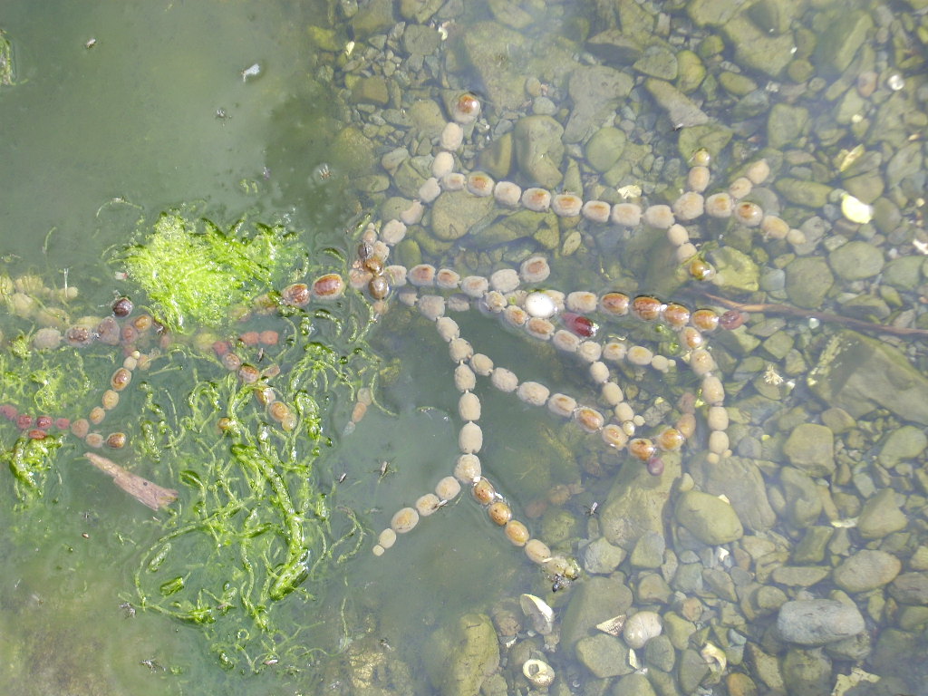
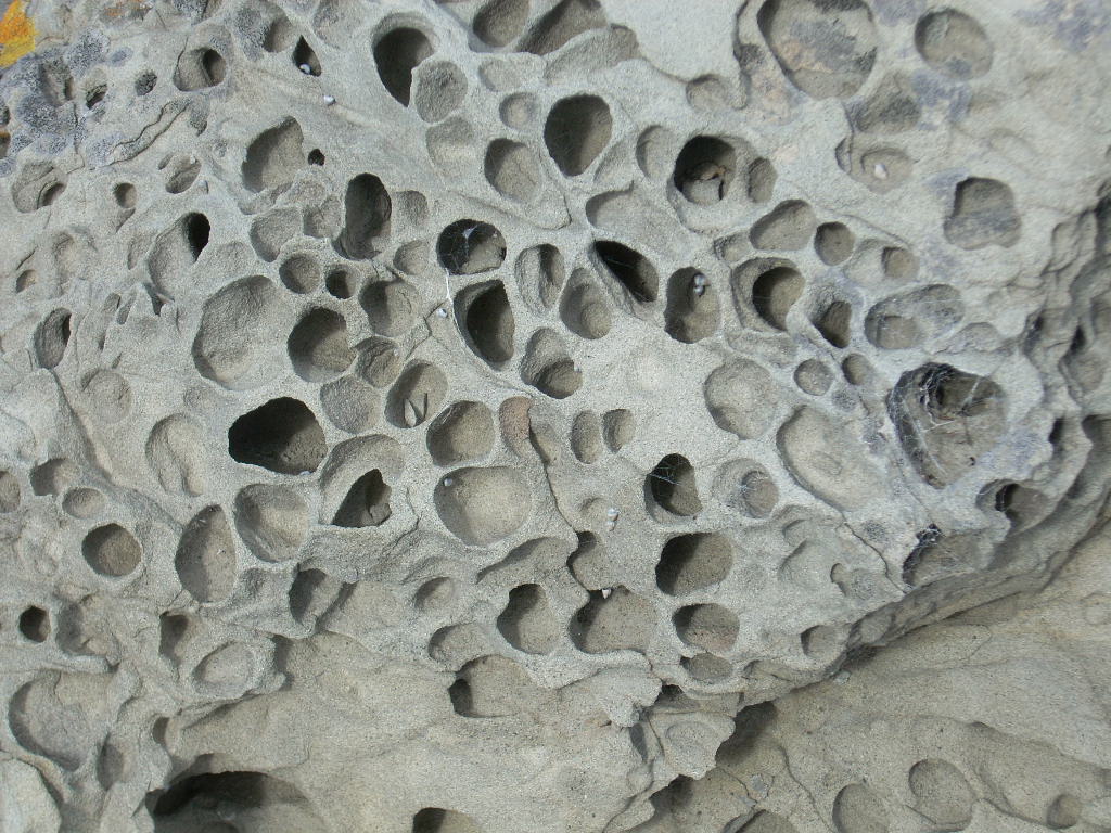
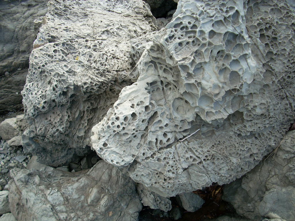
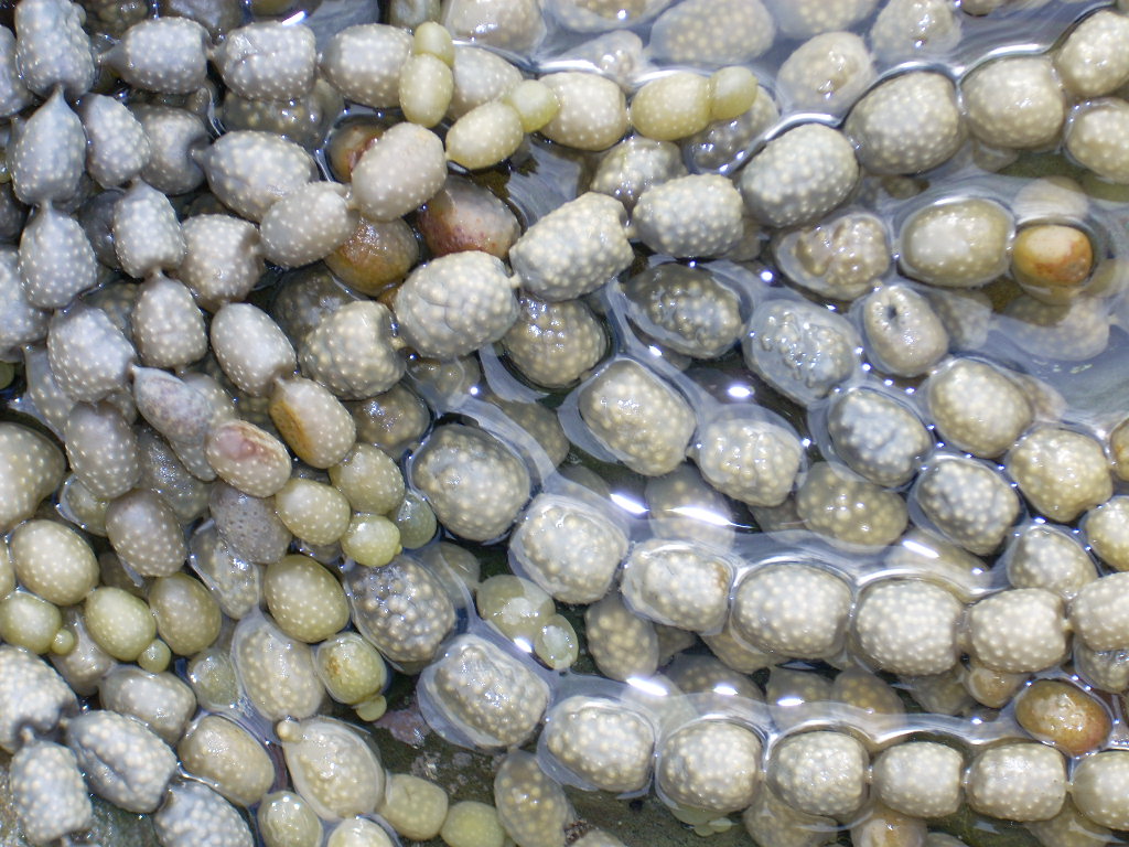
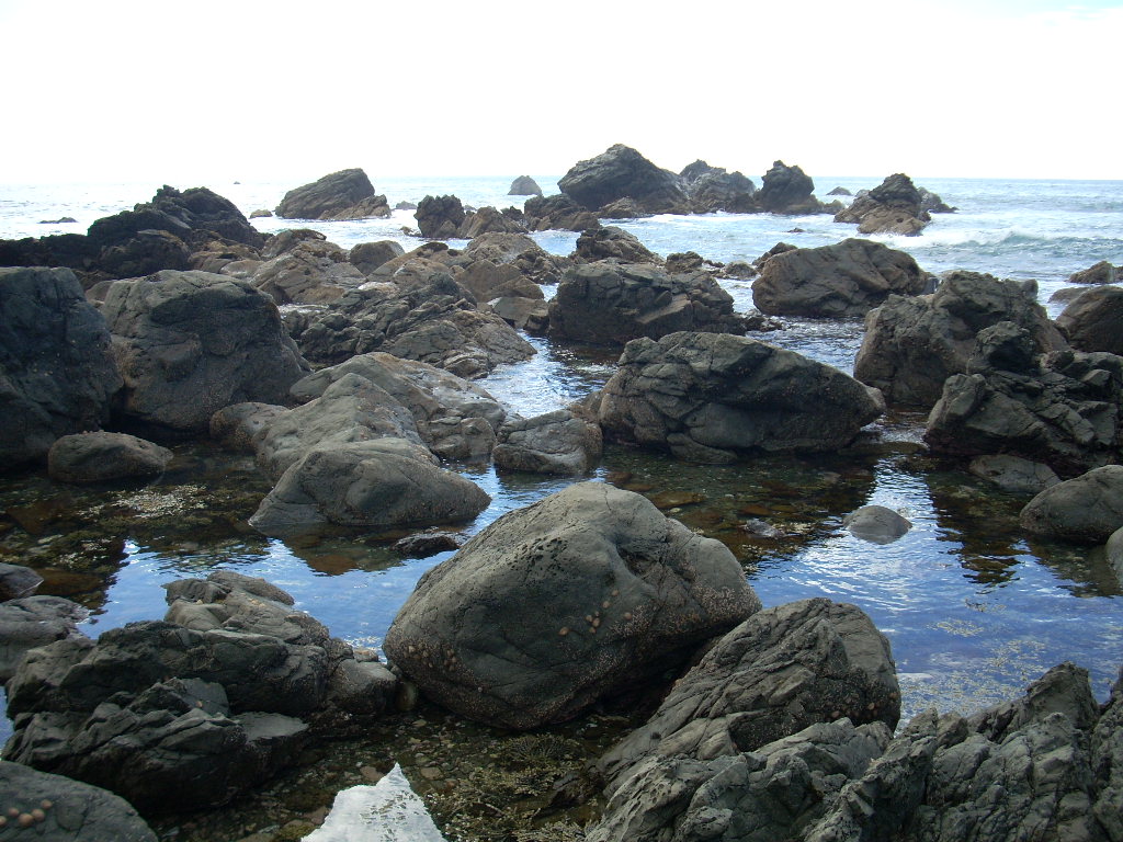
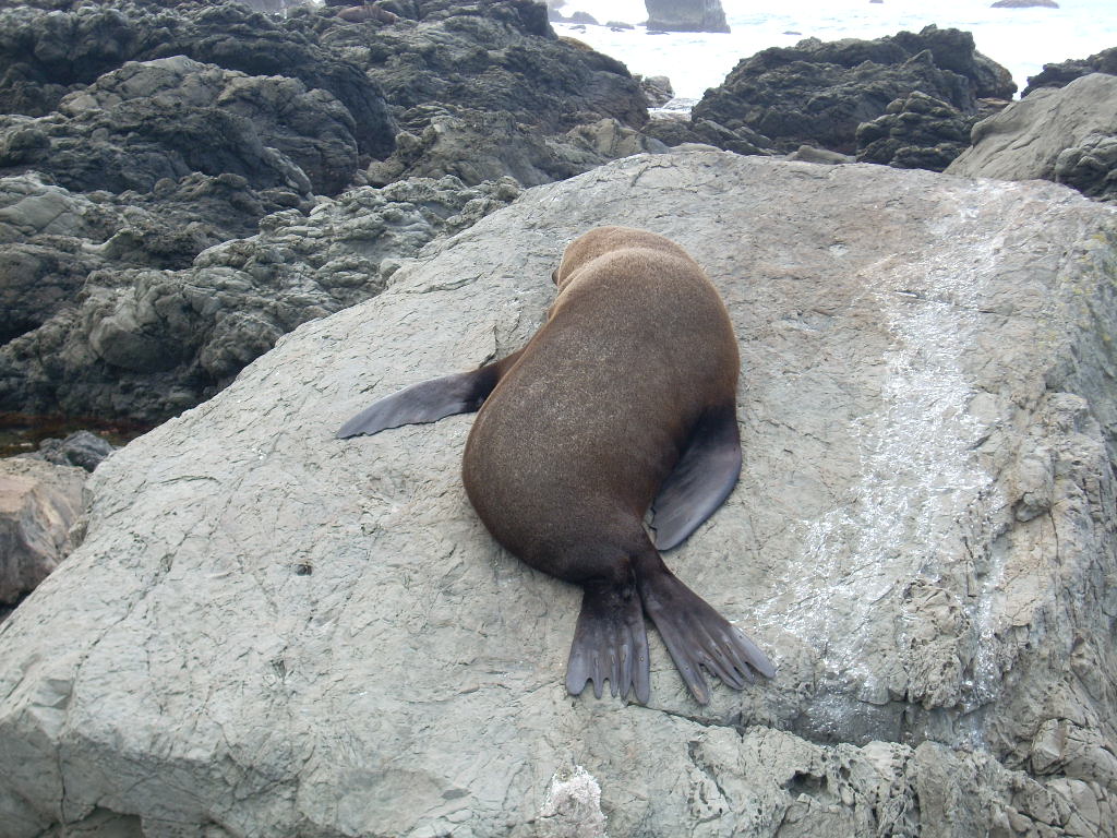
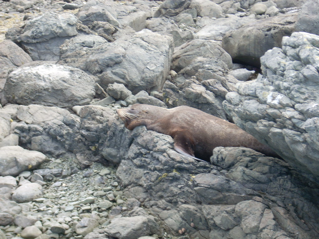
Somewhere 10 or 20 km north of Kaikoura, places to pull over and go to the shore began to appear. I pulled over in one of these and spent almost an hour climbing on the rocks, looking in the tide pools and eventually discovering seals sleeping on the rocks around me where I hadn’t noticed them. The rocks were full of holes like swiss cheese and in the tide pools a marine plant grew into chains like beads. And on the rocks, the seals slept oblivious to the fact that I was walking by 15 feet away. The taller rocks sported covers of yellow lichen. It was an amazingly fun place to wander about and I had it almost to myself.
I rode on and came into Kaikoura soon. This was another place I had been prepped to have great expectations of. It is pretty. I drove up and down and through town several times checking it out and looking for a likely place to eat lunch. 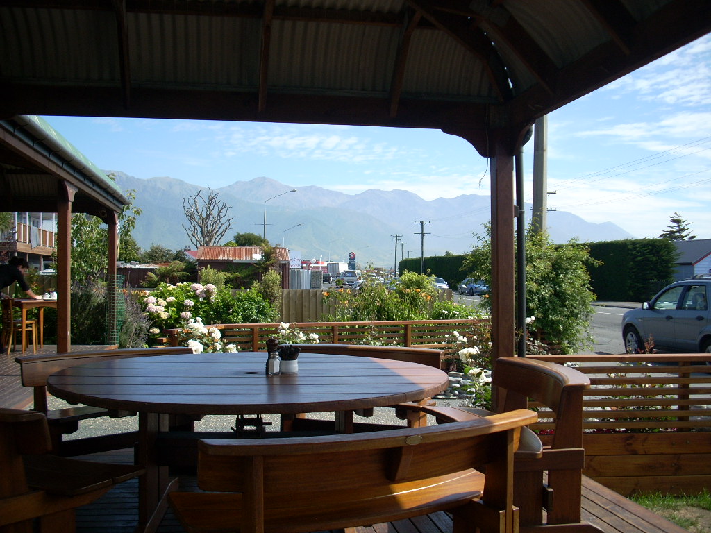 I finally settled on a vegetarian place on the main road where I could sit outside and watch the world go by and read my book and enjoy the day.
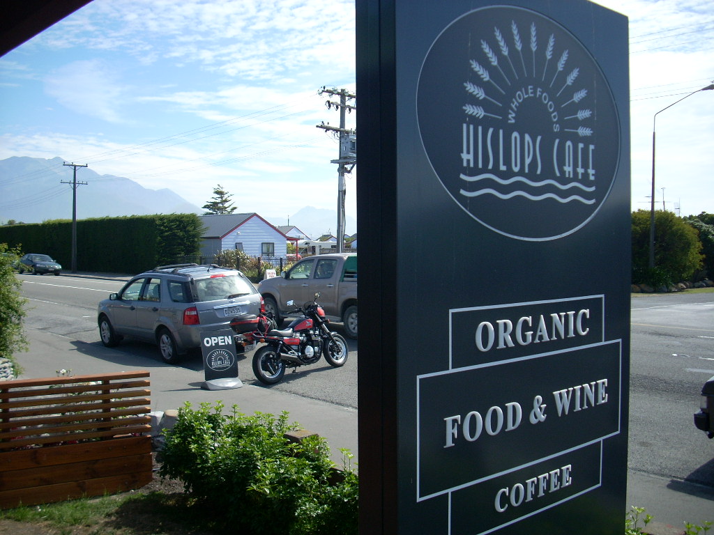
After lunch, I drove around some more. There was a place where you could park and walk out onto an old wharf and I did so. That wharf was old and creaky and you could see it had a long history. 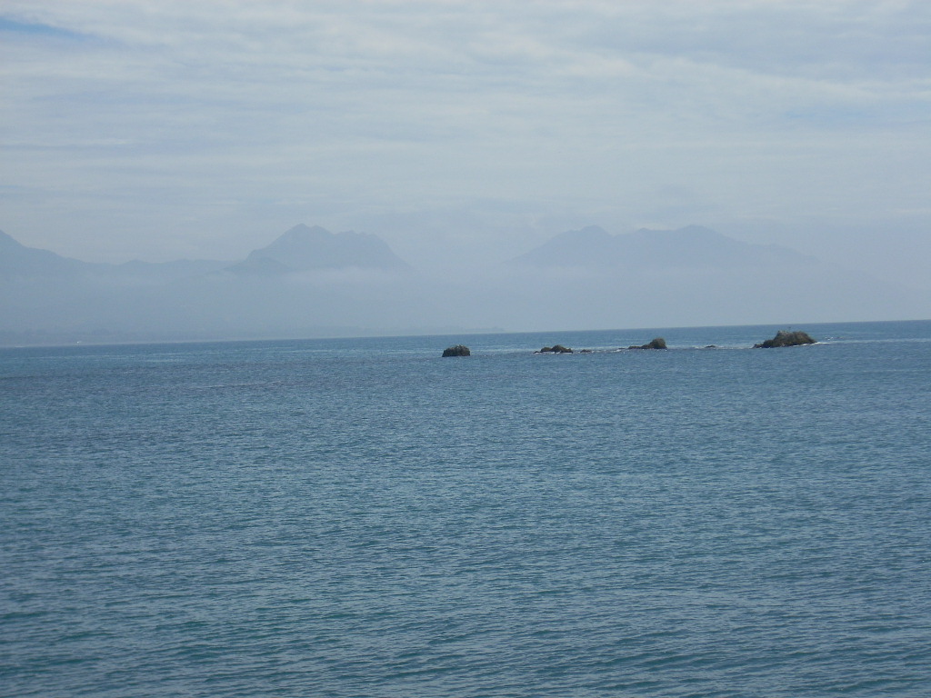 I took several photos across the bay towards the shoreline running north. Only one turned out half way decently. By this time, the 2 GB on my camera’s memory card was getting to be almost full so I was having to pick and choose my shots carefully.
For me, Kaikoura was a bit like Nelson. A special place no doubt but it didn’t, for me, live up to its hype. It was pretty but it wasn’t a place I could immediately identify with and easily imagine myself living there like I had at Takaka. 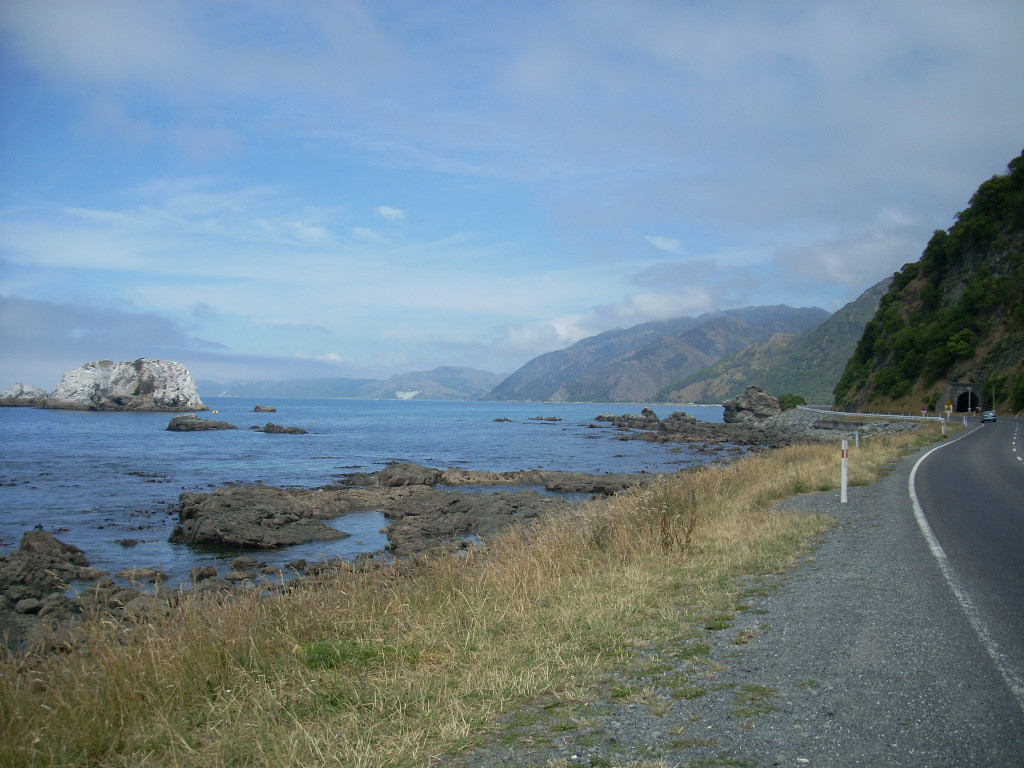 So, I drove about a bit more and then headed south again.
South of Kaikoura, there were some beautiful places and I stopped and took a photo on one that I particularly liked with a big white rock covered by guano out in the sea.
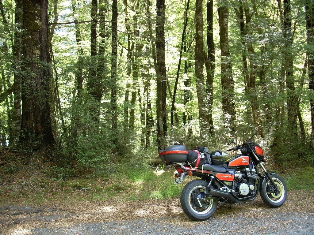
Now I was ready to ride seriously again. I could feel our apartment in Christchurch pulling me. A chance to get off the motorcycle and take a nice long shower. If you’ve never ridden a motorcycle for a long time, it is your butt that becomes the most uncomfortable. You shift up and you shift back on the seat and each shift up or back helps a bit but the sense of discomfort builds up and after an hour or more, you really want to get off and take a walk around. I suppose, if a had a big comfy Harley-Davidson with all the bells and whistles, the comfort level would be a lot higher. My Honda Nighthawk is really a short trip power bike rather than a long-ride touring machine. But, when it comes time to pass the big trucks, it is indeed a pleasure to put the hammer down and hear the 700cc’s, with the four carburetors dumping fuel into it, roar as it blasts you by the big rigs.
The country was mostly bare again here and I was clearly able to see just how dry the eastern mid-section of the South Island is in the rain shadow of the Southern Alps. I hadn’t realized it so much until I compared it with how green and verdant everything was up by Takaka and all across to Picton.
The towns along this long stretch were pretty much non-events until I came to Cheviot. I stopped here for a bathroom break and a cup of coffee. There was a crafts fair in progress and I walked over and browsed through the booths to see what was going on. Two ladies were working spinning wheels and I remembered watching Kathy operate her loom a few weeks before and that she’d had a spinning wheel also in the room – but that I hadn’t inquired into how it worked and what it did.
Spinning wheels are odd things to me. I’ve seen them around on and off all my life but usually as decor rather than as functional machinery. They sit in the corners in furniture stores that sell fine walnut dressers and end tables. And it is subliminally suggested that if you buy one and put it in the corner of your living room, it will cause your guests to hearken back to simpler times and feel a sense of permanence as they gaze on it and that they will then realize your deep stability. We didn’t have one at my house.
Well, that’s all fine. But watching these two ladies, I realized I didn’t really know what a spinning wheel did – so I put on my best smile and went over and shared my ignorance with them.
One of them explained it all too me as she ‘spun’. The wool being ‘carded’ and then spun out into a long initial threads. And then, later, two such threads being cross-wound together on the same spinning wheel to form a double thick thread and so that each of the two constituent threads were wound in the opposite direction. I got it and I saw then how the output of the spinning wheel would then became the natural input of the loom.
Cool. 60 years old, and the boy from Los Angeles finally understands the technology.
From Cheviot, there was a road that led down to a place called Gore Bay on the coast. I decided to take the road down and see what the place looked like.
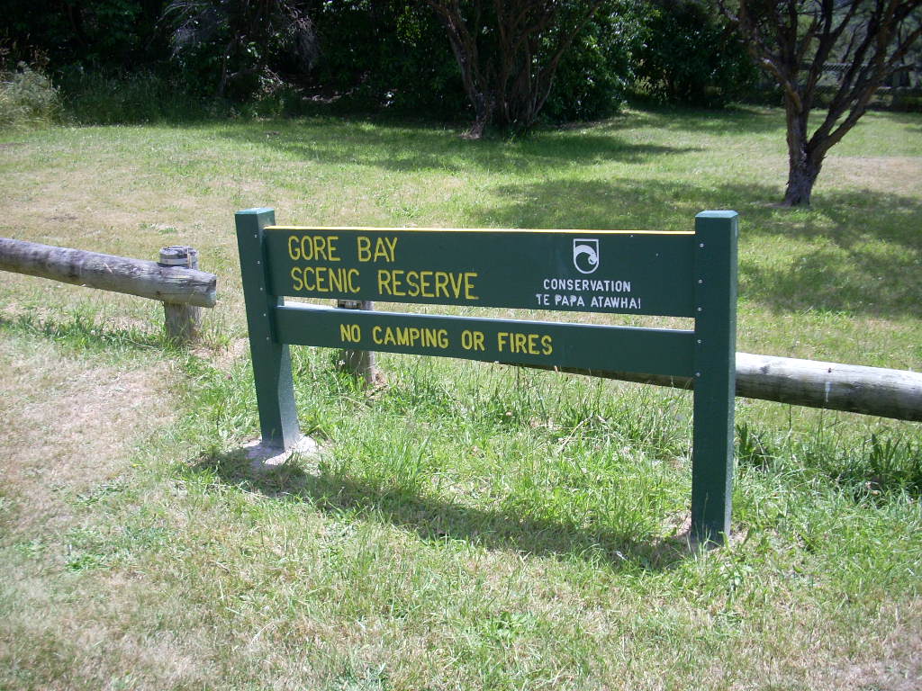 It was nice. There was history here as well. A long time ago, Gore Bay was a big shipping point until the services moved off elsewhere.
 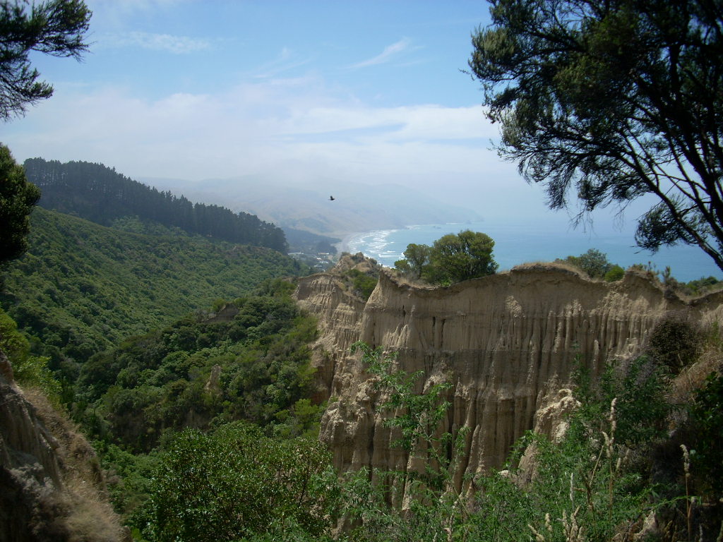 Now it is a quiet place with a lot of nice bachs and boats in attendance. Once I got through the bay and begin to climb back up inland towards Highway 1, there was a nice lookout point and I turned off and took some photos,
 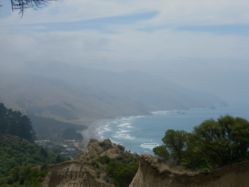 That was a very pretty view.
Well, this was the end. Once I got back up onto Highway 1, I knew the next stop would be Christchurch and home. Again, long stretches of rolling dry hills with some greenery here and there. Miles and miles of watching signs advertising Greta Valley and when I got there it was a coffee shop, basically. I blazed on by.
Then on down to Spye and Omihi and then finally through Waipara where, on the way north, I’d turned inland to head for Springs Junction. And, this same Waipara was also the taking-off point for my earlier adventure down Cass Road to the Omihi Forest when I walked so many miles in the heat almost down the the beach before turning back.
Now I was on familiar road. I could remember riding back from my walk down to the Omihi Forest and how tired I was. I could remember all the same signs along the road and where I’d stopped to get that oh-so-good bottle of orange juice.
The miles rolled under my tires and as I got closer to the city, the roads widened and there were more cars and I could sense that people were driving in a different state of consciousness that they were out on the country roads.
Finally, the highway ended and we got into city streets and stop lights. That was strange – to feel the pace change so drastically. It all seemed alien to me and it had only been a few days. I watched the cars more closely to see if people were going to do stupid things which is always more likely in an urban environment.
Papanui went by and then Merivale and finally I could see the shops on Victoria Street near where I live. A right turn onto Peterborough and then a right into my building, through the gate and down into the parking garage and finally to park the beast.
The end of a fine adventure – home safe and sound.
Cheers!
Tags: Honda Nighthawk, Motorcycle Trip, New Zealand, South Island, Takaka
only counted six pics of a KH and one of two lovers and a couple of their problems. 🙂
Mark, if you go to the opening page of the site and enter ‘motorcycle’ in the search box, you are going to find a lot of what you think you are missing.