 I went off today on another big motorcycle adventure. This will probably be my last one this trip as I am departing for the US on Tuesday.
Today, I went off east from Christchurch searching for a particular type of land. Hilly and wooded land with natural woods, not managed forest. This type of land is harder to find here than many folks might think. Much of the Canterbury Plains have been cleared of its original cover in favor of grazing lands or managed forests. You can go for very long stretches in some areas and see nothing else.
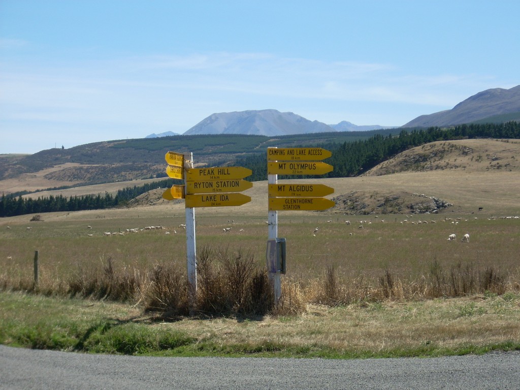
Today, I headed east out of Christchurch on Hwy 73 until I got to Darfield when I switched onto the eastbound Hwy 77. This took me to Glentunnel when I took my first excursion off the main road. Glentunnel is the beginning of an area that fronts up the the southern flanks of some foothills of the Southern Alps. It is in areas like these that we think we have the best chances of finding the kind of land we’re looking for. At Glentunnel, I went north to Whitecliffs and then west again on gravels roads that took me onto the north side of Pullwool Peak and Mt. Misery Peak.
I found this area disappointing. On the map, it is marked as the Glen Arlie Forest and I’ve now begun to understand that here in NZ, an area marked forest generally means ‘managed forest’. And I ‘get’ now that the many roads shown weaving through the bodies of these forests are not there because they are densely settled with holiday homes but rather because they are logging roads which the New Zealanders, oddly enough, give names to just as if they were normal roads. So, enough with ‘forests’ on the maps.
The entire Canterbury Plains is a relatively dry area as well. It isn’t unusual to see big mountain ranges on the western side just as bare as a baby’s butt. I don’t know if they’ve always been like that or if they were logged off earlier and have just degraded into bare rock and soil but they look very bare. In general, the plains and the foothills are mostly areas cleared for crops or grazing or for managed forests.
After the disappointment of the Glen Arlie Forest, I continued west on Hwy 77 to Windwhistle. here I cut north to Coleridge Road. And from it, I went a long spur to the east called High Peak Road. It was pretty, but again, it was grazing or managed forests. Then I cut back to Coleridge Road and was just going to go north for a bit.
I can see now that when I was on my way to Windwhistle and I did some exploring on Washpen Road, I missed a good bet when I failed to go north up Dart’s Road because I see now that it went up and into a Conservation Area called Rockwood (which I now understand is likely to hold the kind of forest we’re looking for). I’ll need to revisit this area next time.
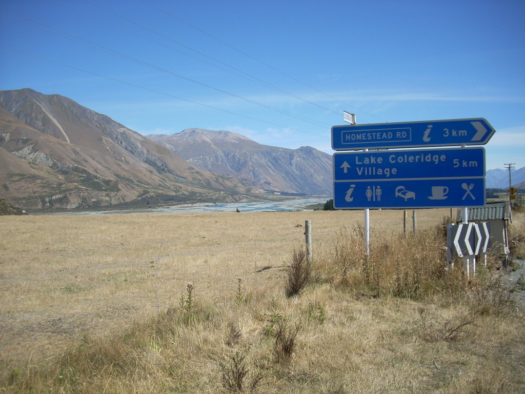
But I continued on Coleridge Road because the valley I found myself in, while not naturally forested, was arrestingly beautiful. On the western side, a huge range of bare but imposing mountains rose up over one of New Zealand braided rivers; the Rakaia.  Far to the west at the head of the valley, some of the big southern Alps rose up, covered with snow. I kept driving and driving just to see more and went miles away from the places I’d intended to investigate. I was tempted to just keep going and let the wanderlust take me but finally, I stopped at a place called Lake Coleridge; a town with the same name as a nearby lake. The road goes on for awhile beyond Lake Coleridge but I could see on the map that it just died before long. So, Lake Coleridge was literally the end of the world. A strange place. I think it mostly exists to support the hydroelectric plant there.
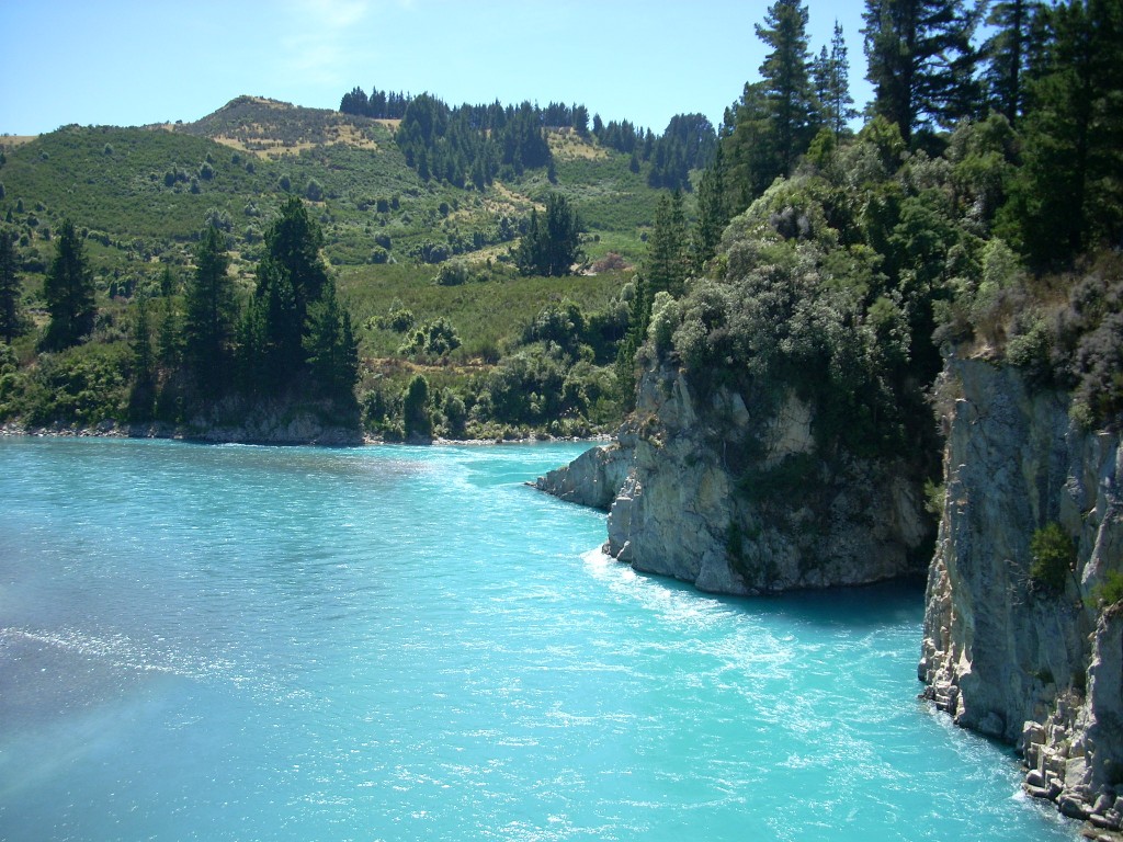
  They bring water over the hill from Lake Coleridge and huge pipes and deliver it to the plant by gravity which uses it to spin the turbines and then dumps it into the Rakaia River.
I turned around after taking a look at Lake Coleridge and its plant and headed back to Windwhistle where this diversion began. Once there, I turned west again and continued to follow Hwy 77.
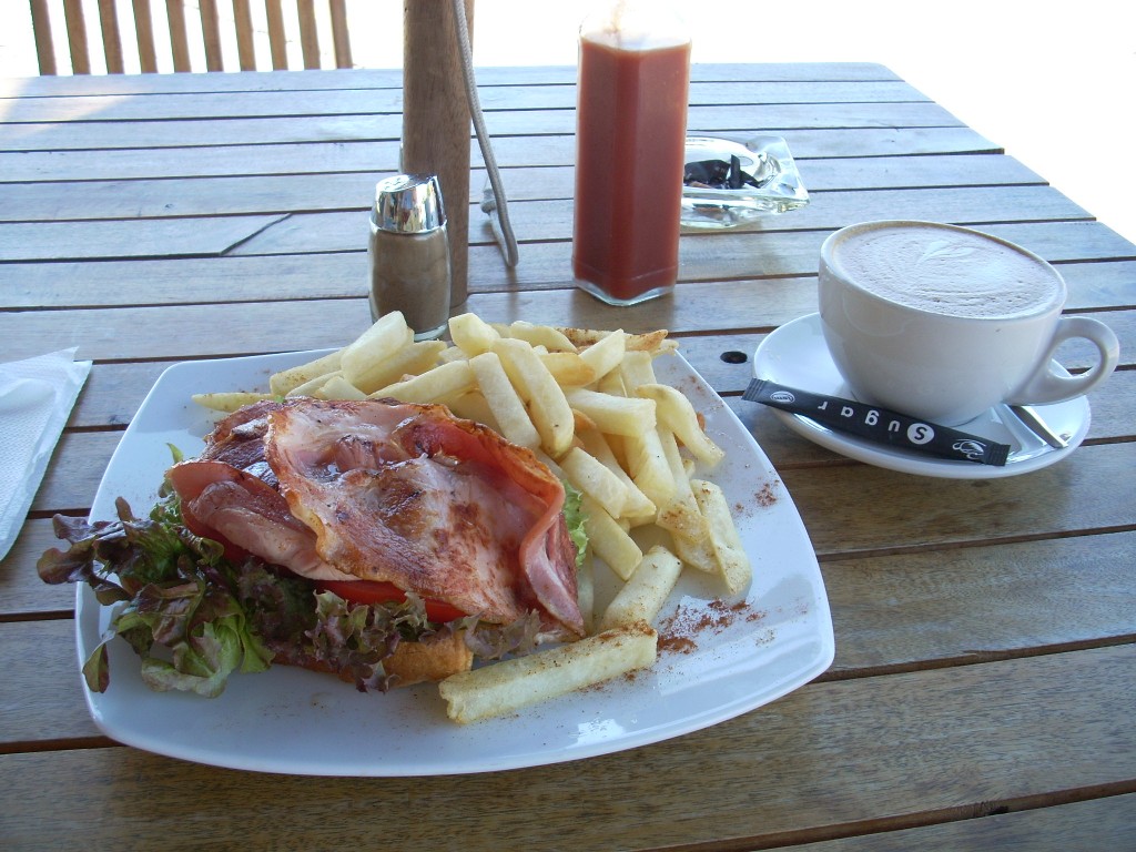
 I was running low on gasoline and it was time for a cup of coffee and some lunch so I took a detour down to Methven, a touristy town a few miles south, and filled up (an attendant who knows motorcycles came out and had a very good look at my motorcycle because very few of this model have ever made it to New Zealand) and I then had a Latte and a BLT at an outside table at a restaurant on the main drag in town. Ordering food in New Zealand can still bring the occasional surprise. The BLT, when it arrived, was open faced and had the NZ style thin round cut bacon on it. Surprising – but excellent to eat!
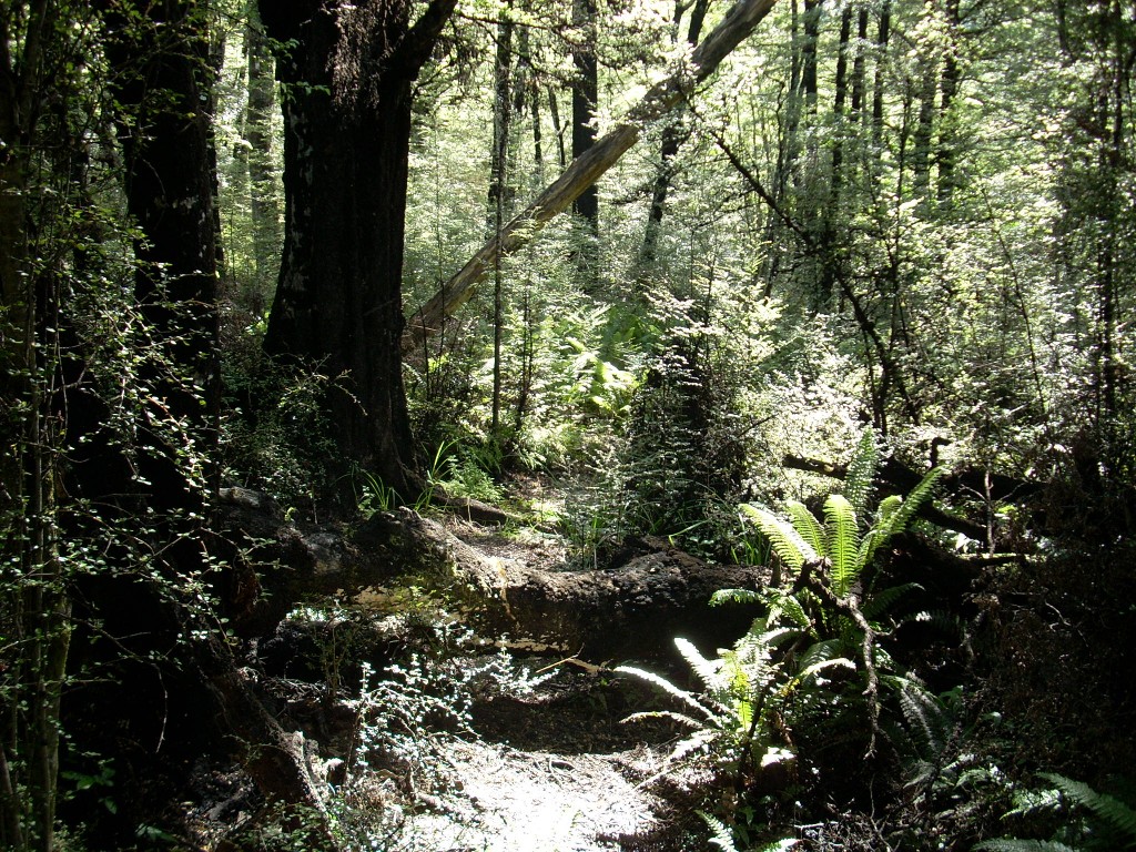
The next area I was interested in was the Alford Conservation Area and, specifically, the southern slopes of the area’s foothills. As I approached the area, I could see that the foothills here were forested and it looked like natural forest. Yahoo. 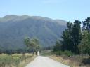 I went up a couple of the gravel side roads trying to get up into it and on the second one, Flynn’s Road, I got lucky and it took me right into the forest and to a trail head area that serves as a stepping off point for hikes to Sharplin Falls and other points. I spent a fair amount of time here shooting pictures and walking around. It was definitely the right kind of country.
 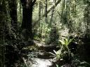 And it soon occurred to me that the real question was did anyone have private land for sale in the area that abutted the Conservation Area and that contained this same type of forest.
Today was suppose to be a partial solar eclipse here in New Zealand (unless I’ve been the victim of a hoax) and it was due to hit maximum darkness at 437 PM. It was now about 405 PM and so I decided to zip down the Hwy to Mt. Somers and find a place to have an ice-cream cone and sit outside and watch the fun.
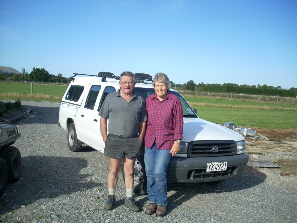
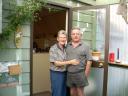
This was a very good decision. (I found out the following day that the eclipse was, indeed, real but I was unable to see it using the pin hole in a paper method). In the meantime, a fellow came up to the store where I was sitting eating my ice-cream and we began to talk and I asked him about properties in the area. What a stroke of luck that question was. Ken had moved from Christchurch nine years earlier to the Mt. Somers area and knew many of the farmers who owned properties along the southern flanks of the conservation area foothills. He invited me home for a cup of tea where I met his wife, Lynn, and he made a phone call to a friend of his with a property in the area I was interested in and off we went. How very lucky is that?

Jocelyn and her husband, Errol, own 94 hectares or about 233 acres of land just at the base of the foothills. She took Ken and I on a long tour of the place. A beautiful property it is. Paddocks, creeks, good outbuildings, well maintained and great views. After a good look around, I came to doubt it’s the place for us, though, as we’re looking for a place with more hills, less pasture and more forest (or bush as the Kiwis say) on it but someone’s going to get a great place here.
While we were looking at one corner of Jocelyn’s place that did have some bush on it, I ask them about the black encrustations I see on so many of the trees in naturally forested areas in New Zealand. They said it was a bug that lives there and that if you look close you can see a little hair that it puts out that often has a small drop of honey-like liquid on it. Honeydew, it is referred to. Sure enough, I looked and saw what they were talking about. They said it seems harmless to the trees and it’s been around for a long time. When I got home last night, I did some searching on the Internet and came up with some more information about what going on with this black encrustation. They are called, “Sooty beech scale insects”.
Ken and I went back to his placed and talked for a bit more. By now, it was 730 PM and I needed to take off for my ride back to Christchurch before it grew dark. Ken invited me to stay for tea (that’s how Kiwis refer to the evening meal) with he and his wife and daughter and her partner but I declined after consulting my watch. So, a few handshakes, the exchange of E-mail addresses and I was off. What a great bit of luck to meet someone like Ken who knows the area so well.
The ride home wasn’t much fun. Long straightaways across the Canterbury Plains at 100 kpm blasting into the teeth of a strong wind. But, it passed and about 830 PM, I arrived home after putting 220 miles or about 366 km on my bike for the day. A great machine, by the way. Never a complaint and it just roars down the road straight and true.